10 October 2026
Fine spells. Isolated showers developing around midday, becoming confined to the ranges in the evening. Northeasterlies, turning northwesterly in the evening.
Loading outdoor place details…
Tongariro National Park
The Round the Mountain Track showcases the varied volcanic landscapes and alpine vegetation on the flanks of the active volcano Mount Ruapehu.
Distance
73.4 km
Walking time
4 - 6 days
Difficulty
Advanced
Dogs
Not allowed
Wheelchair access
Not marked friendly
Current status
Weather outlook
Issued 10 Oct 2026, 10:55 am
10 October 2026
Fine spells. Isolated showers developing around midday, becoming confined to the ranges in the evening. Northeasterlies, turning northwesterly in the evening.
11 October 2026
A few showers. Northwesterlies, dying out in the evening.
12 October 2026
A few showers. Northwesterlies, dying out for a time in the afternoon and evening.
13 October 2026
A few showers. Northwesterlies developing in the morning.
14 October 2026
Partly cloudy with a few showers developing in the morning. Northwesterlies.
Regional guidance only; elevation and terrain can produce different conditions.
Explore the area
Explore the track route and surrounding area before you set out.
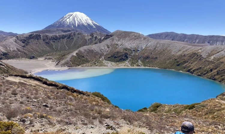
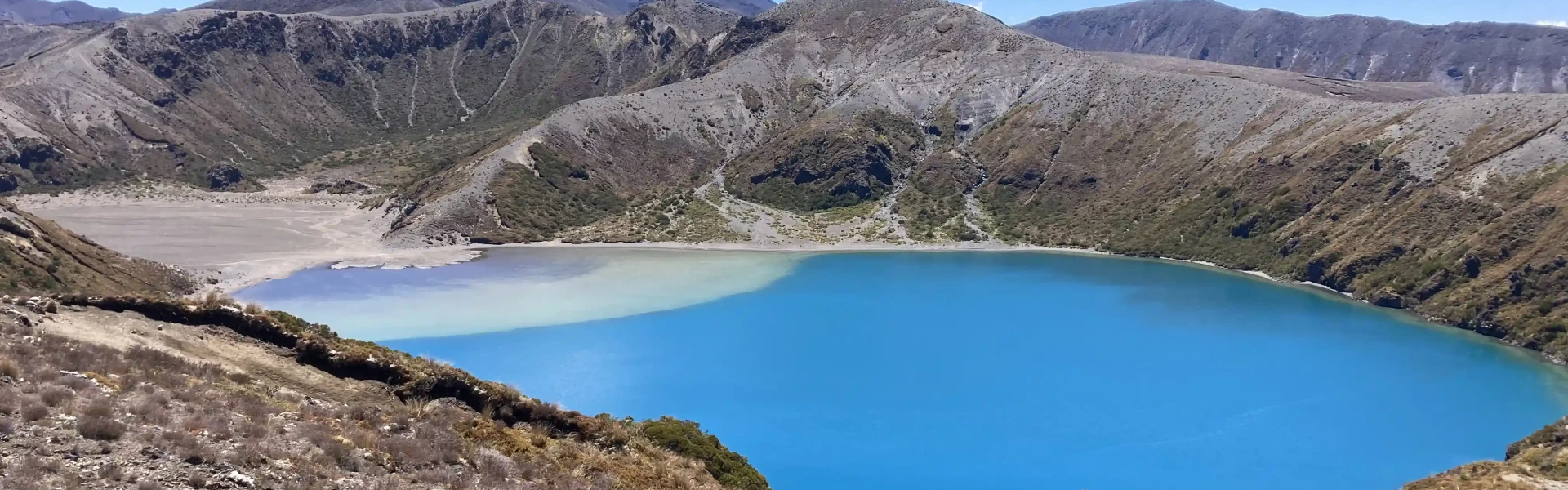
The track begins along Ngauruhoe Place, 100 metres below Whakapapa Visitor Centre. There are two options. The Lower Taranaki Falls Track crosses tussock and shrubland before following the Wairere Stream through mountain beech forest to the base of Taranaki Falls. On leaving the falls, the track climbs a set of steps and brings you to the junction with the Upper Taranaki Falls Track (1 hour 25 minutes to this point). Alternatively, the Upper Taranaki Falls track takes you over tussock and shrubland to the same point in 1 hour. After leaving the Taranaki Falls Track, it is a further 2 hours to Tama Saddle and Tama Lakes junction. From here a side trip can be made to the Tama Lakes. Tama Saddle is exposed and conditions can be windy in bad weather. From Tama Saddle the track gradually descends for 2.5 hours down the Waihohonu Stream to Waihohonu Hut. A side trip can be made from the Round the Mountain track to the historic Waihohonu Hut, about 10 minutes before you reach the new Waihohonu Hut. Side trip: Tama Lakes 20 min return to Lower Tama Lake from the junction or 1.5 hours return to Upper Tama Lake from the junction. Tama Lakes, two infilled explosion craters, are named after Tamatea, the high chief of the Takitimu Canoe, who explored the area six centuries ago. The lower lake (at 1200 m), is 10 minutes from the junction. Volcanic debris is slowly washing in and filling the crater. The upper lake (at 1314 m) is a further 40 minutes up a steep ridge. This beautiful lake is reputed to be very deep.
The track from Waihohonu Hut to Rangipo Hut is in one of the most unique areas in the park. It is the only true desert landscape in the North Island, and as such, features vast plains of wind sculptured sands and volcanic rock. The Rangipo Desert is dryer than most areas in Tongariro National Park as it is sited in the rain shadow to the east of Mt Ruapehu. The track passes Ohinepango Springs then traverses the eastern side of Ruapehu, past the Tukino Mountain Road, the Whangaehu River, eventually arriving at Rangipo Hut. The hut is perched on the southern edge of the desert with views east to the Kaimanawa mountains. Side trip: Ohinepango Springs 5 min return from the Round the Mountain Track or 1 hour return from the new Waihohonu Hut. Crystal clear cold water bubbles up from beneath the old lava flow and discharges at an enormous rate into the Ohinepango Stream. The springs are signposted on the Round the Mountain Track heading towards Rangipo Hut.
The trip from Rangipo to Mangaehuehu is an undulating traverse. It leaves the desert lands of Rangipo, re-entering the mountain beech forest on the southern flanks of Mt Ruapehu. A feature of this section of track is crossing the awesome Waihianoa Gorge which cuts a path down the mountain into Karioi Forest.
The gradual downhill traverse from Mangahuehu weaves through open alpine tussock country and mountain beech stands. After 1 hour 30 minutes, a track junction gives walkers the option of a side trip to Blyth Hut (1 hour return) or continuing out to the Ohakune Mountain Road. About 20 minutes past the track junction are the Waitonga Falls (39 m), reputedly the highest falls in Tongariro National Park. The track out to the road passes Rotokawa, an alpine tarn featuring several alpine wetland species and spectacular views of Ruapehu on a clear day. A second junction indicates the Old Blyth Track (1 hour 30 minutes to the 7-kilometre point on the Ohakune Mountain Road) on the left, or 15 minutes to continue on to Waitonga Falls carpark (the 11-kilometre point on the Ohakune Mountain Road). The track begins again 3 kilometres further up the road from the exit of Mangaehuehu Hut and Waitonga Falls track (15 kilometres from Ohakune township). After leaving the road, follow the track down into the Makotuku Valley, then cross a lava ridge covered in alpine herbs. The track then descends into the expansive Mangaturuturu Valley via the Cascades, where a mountain stream tumbles over a spectacular rockfall. The rocks are coated with a creamy-coloured silica deposit left behind by the fast-flowing stream. Caution: the rocks can be slippery during wet or icy conditions.
Shortly after leaving the hut, the track crosses the Mangaturuturu River. Caution: It may not be possible to cross safely when the river is high during or following rain. The riverbed was scoured out in 1975 by a lahar (volcanic mud flow), thus the sides of the river are devoid of established vegetation. A climb out of the valley brings you to Lake Surprise, a shallow alpine tarn. The staircase that climbs up from Lake Surprise onto the ridge above, was constructed to protect the fragile alpine environment. The traverse to Whakapapaiti features two magnificent river valleys, the Manganui-o-te-Ao and the Makatote. These rivers merge in the Ruatiti Valley then flow into the Whanganui River to the sea. This part of the track features views of Hauhungatahi, a conical peak to the northwest of Ruapehu, as well as spectacular waterfalls tumbling off lava bluffs in the Whakapapaiti Valley. At the junction just before Whakapapaiti Hut, you have the option of continuing on to Scoria Flat on the Bruce Road (1 hour 30 minutes) or turning off to Whakapapaiti Hut (15 minutes) and on to Whakapapa Village (2 hours 30 minutes).
From Whakapapaiti Hut the track continues down the valley. 15 minutes below the hut it crosses Whakapapaiti River. When the river flow is low, you can boulder hop across - but after rain it is not possible to cross safely. You can avoid the main river crossing and exit along the top return route to the Bruce Road at Scoria Flat, 5 km above Whakapapa Village. About 45 minutes below the hut the Mangahuia Track branches off to the left (to Mangahuia Campsite and SH47). The track to the village continues straight on then veers east. Interesting features of this area are the groves of kaikawaka and cabbage trees amongst the beech forest. From here the track undulates for a number of easy climbs and descents before joining the well-formed Silica Rapids Track, for the last 45 minutes to Whakapapa Village.
Most of the track is on rugged and exposed alpine terrain, there are just a few sections of forest around the western and southern sides. The lowest altitude of the track is about 1100 m, and the highest (at Rangipo Hut) is close to 1600 m. There are some unbridged streams and river crossings, including the two larger rivers - the Whakapapaiti and Mangaturuturu rivers on the western side of Ruapehu. Major hazards on the track are generally managed during summer (October to April). In winter the main hazard is snow/ice on the track. We recommend you treat stream water to guard against risk of infection from giardia and other bugs. During winter months snow/ice can cover all or parts of the track, and avalanche danger may be present. Walking and/or navigation can become more difficult. Alpine experience and equipment is required during this period (crampons, ice axe, possibly avalanche transceiver, shovel and probe).
There are six huts with campsites available on the Round the Mountain Track: Waihohonu, Rangipo, Mangaehuehu, Blyth, Mangaturuturu and Whakapapaiti. Waihohonu Hut and Campsite requires advance booking in the Great Walks season. Outside the Great Walks season, it is first come, first served. All other huts and campsites are first come, first served all year.
You can access the Round the Mountain Track from several locations, providing options to walk part of the track over a couple of days, or to do the complete circuit. Most choose to start and finish at Whakapapa Village. Use this location in Google Maps to find your way there.
We encourage you to continue gaining the skills and knowledge required for a safe trip. The NZ Mountain Safety Council has lots of free resources and information you can use. These can be accessed via www.mountainsafety.org.nz . We recommend trying these online learning tools: Trip Planning Tramping / field Skills Basic Navigation River Safety Additionally, check out the range of helpful videos available from the NZ Mountain Safety Council YouTube channel .
The weather in Tongariro National Park is often more extreme than other places in the North Island. Strong westerly winds and heavy rain are prevalent whenever a frontal system is moving up from the southwest. Snow is possible at any time of year. Heavy rain can make the unbridged streams and rivers impassable. Be prepared to wait for water levels to drop. Never cross a flooded river! Be prepared for cold, wet, snowy/icy, or windy weather at any time of year.
No dogs.
Track information, access and weather can change. Confirm current alerts and land-manager information close to departure, tell someone your plans, and carry equipment appropriate for the route and conditions.