11 October 2026
Showers, possibly heavy, easing in the afternoon, clearing early evening. Northerlies, turning westerly in the afternoon, easing in the evening.
Loading outdoor place details…
Lewis Pass Scenic Reserve
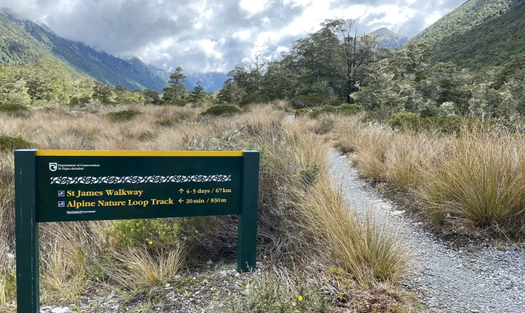
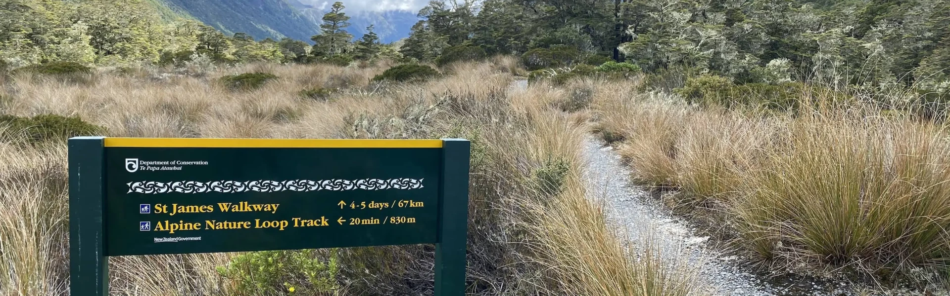
This track passes through pastoral land, beech forest and sub-alpine regions. This track is part of Te Araroa Trail.
Distance
66 km
Walking time
5 days
Difficulty
Easy
Dogs
Not allowed
Wheelchair access
Not marked friendly
Current status
Weather outlook
Issued 10 Oct 2026, 11:01 pm
11 October 2026
Showers, possibly heavy, easing in the afternoon, clearing early evening. Northerlies, turning westerly in the afternoon, easing in the evening.
12 October 2026
Fine. Northwesterlies developing for a time in the afternoon.
13 October 2026
Mostly cloudy with isolated showers, becoming widespread for a time in the morning and afternoon. Northwesterlies developing in the morning.
14 October 2026
Rain with some heavy falls. Northerlies.
15 October 2026
Showers, some heavy. Southeasterlies developing.
Regional guidance only; elevation and terrain can produce different conditions.
Explore the area
Explore the track route and surrounding area before you set out.
Distance: 7 km to Cannibal Gorge Hut, 10 km to Ada Pass Hut The track leaves the picnic area on the Tarn Nature Walk across a natural open bog. It then enters the bush, descending in a steep zig-zag into Cannibal Gorge on the Maruia River. A swing bridge crosses Cannibal Gorge to the true right bank. From here it is about 6 km to the Cannibal Gorge Hut. Past the hut the track follows an easy grade alongside the Maruia River, through beech forest and open alpine fields (prone to avalanches) to Ada Pass Hut (3 km - 30 minutes).
Distance: 10.5 km From the hut, the track leads through bush over Ada Pass into the Ada valley. Beech forest gradually gives way to open areas of tussock with tongues of mountain beech. Orange triangles at the clearing edge indicate the start of the track through bush areas, following the true right bank of the Ada River. At the confluence of the Ada and Christopher rivers, the track passes the historic Christopher (Ada) Cullers Hut. The Christopher Hut is 10 - 15 minutes walk from this point, close to the edge of the bush, about 350 metres from the Ada River.
Distance: 13 km From Christopher Hut the route goes down the valley along the true right bank of the Ada River to where the open flats converge with the river and toe of the hill, about 1.5 km above the Ada homestead. The track eventually joins a vehicle track for some distance to the Henry / Waiau valley confluence. From here it passes through matagouri thickets and some open rolling and swampy ground and re-joins the vehicle track (up till now the track is on the true left bank of the Henry River). After crossing a suspension bridge over the Henry River, the track follows close to the true right bank, before re-joining the vehicle track through to Anne Hut.
Distance: 17 km The track crosses a footbridge over the Anne River to gain access to the true left, and 2 km upriver it crosses another footbridge back to the true right. The track continues up and over the Anne Saddle into the Boyle Valley. Orange pole markers indicate the route over the Boyle Flats, past the basic Rokeby Hut. The true left bank is followed to a suspension bridge over the Boyle River, 100 metres from the Boyle Flat Hut.
Time: 5 hr Distance: 14.5 km After re-crossing the footbridge to join the walkway route on the true left bank, follow markers to the start of the track through the gorge. A suspension bridge crosses the Boyle River, then the track follows the true right bank to another suspension bridge. Magdalen Hut is 30 minutes from this second bridge. A vehicle track is joined and followed down the valley to the shelter and car park at SH7by the Boyle settlement.
The walkway is not difficult, but the climate can be extreme. It should not be attempted during winter months unless you are an experienced tramper. Travel with a group: Never travel alone. In the event of an accident, there is a better chance of prompt help. Four is a safe minimum. All parties should be self-sufficient in case of an accident or huts being full. Share your plan with friends or relatives. Also sign the record books in both the Boyle and Lewis Pass shelters and huts. If you are overdue, search and rescue action can be taken promptly and effectively. Topo50 series maps: BT23 Lewis Pass, BT24 Ada Flat, BU23 Boyle Village
There are five Serviced huts on the walkway. Bookings are not required: Cannibal Gorge Hut – 20 bunk beds Ada Pass Hut – 14 bunk beds Christopher Hut – 14 bunk beds Anne Hut – 20 bunk beds Boyle Flat Hut – 14 bunk beds In addition, trampers can also stay in Magdalen and Rokeby huts. During the summer it is recommended that you carry a tent as accommodation within the huts is limited and available on a first come basis.
Both ends of the track are on SH7 (Lewis Pass Rd) - one end is near the top of Lewis Pass, and the other end is at Boyle Village. Public transport There are coach and shuttle services providing transport between Christchurch, Nelson and Westport via SH7. Timetables are available from the Hanmer Springs i-SITE. Trampers should aim to arrive at the shelters at least a half hour before the scheduled times, which are approximate. It is up to trampers to signal the bus driver. (Note: timetables are always subject to change). Car parking Car parking is available at both entrances, but the Boyle area is more secure. The area is subject to vandalism. There have been reports of cars being broken into and disabled especially the start of the St James carpark at the top of Lewis Pass. We recommend contacting Boyle River Outdoor Education Centre, who offer secure parking and a drop off service. Book in advance, phone +64 3 315 7082.
We encourage you to continue gaining the skills and knowledge required for a safe trip. The NZ Mountain Safety Council has lots of free resources and information you can use. These can be accessed via www.mountainsafety.org.nz . We recommend trying these online learning tools: Trip Planning Tramping / field Skills Basic Navigation River Safety Additionally, check out the range of helpful videos available from the NZ Mountain Safety Council YouTube channel .
No dogs.
Track information, access and weather can change. Confirm current alerts and land-manager information close to departure, tell someone your plans, and carry equipment appropriate for the route and conditions.