11 October 2026
Partly cloudy with a few showers clearing this evening.
Loading outdoor place details…
Tongariro National Park
Walk to Taranaki Falls (20 m) and enjoy excellent mountain views and a range of land forms on a loop track. This track is part of Te Araroa Trail.
Distance
6 km
Walking time
2 hr
Difficulty
Easy
Dogs
Not allowed
Wheelchair access
Not marked friendly
Current status
No active alerts found. Conditions can still change, so check again before leaving.
Weather outlook
Issued 11 Oct 2026, 7:33 am
11 October 2026
Partly cloudy with a few showers clearing this evening.
12 October 2026
Cloud about the terrain lifting in the morning and becoming mainly fine. Isolated afternoon showers then clouding over again in the evening with possible late drizzle.
13 October 2026
A few showers, widespread and heavier in the afternoon and evening.
14 October 2026
Showers.
15 October 2026
Showers, turning to heavy rain, with snow to 1900 metres.
Regional guidance only; elevation and terrain can produce different conditions.
Explore the area
Explore the track route and surrounding area before you set out.
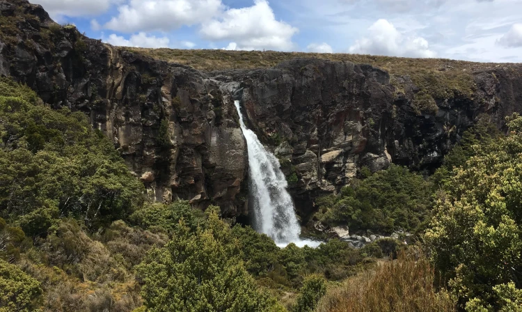
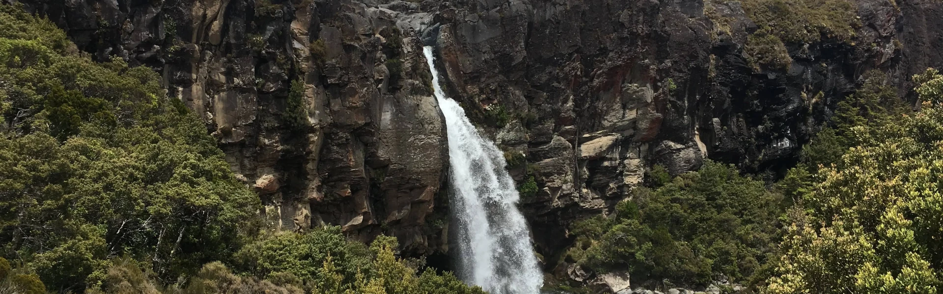
This track can be walked in either direction with the Falls situated around the halfway point. The lower track (more sheltered on windy days) passes through tussock and alpine shrublands before entering beech forest. On a clear day Ngauruhoe’s symmetrical cone and the older, eroded mountains of Tongariro and Pukekaikiore are visible. Once in the forest, the track descends to Wairere Stream then climbs alongside it, passing Cascade Falls. The track then passes over the Wairere Stream with impressive views of a small narrow gorge. Continuing on up the track, Taranaki Falls comes into view tumbling 20 metres over the edge of a large andesite lava flow which erupted from Ruapehu 15,000 years ago. The trail from the falls climbs up a flight of 100 steps to a forest of mountain toatoa before joining the Tama Lakes Track. Turn right to return to Whakapapa, cross Wairere Stream and climb the shoulder of the lava flow, now covered with red tussock. The return track crosses a series of eroded gullies formed by wind, rain and frost action on volcanic soils. As the trail begins to sidle around the slopes of Mount Ruapehu, it merges with the wider old Waihohonu horse trail. Here, layers of pumice and ash from previous eruptions are exposed. After passing through the last patch of bush, the track emerges again into red tussock and manuka, leading easily back to the village.
The lower track is more sheltered on windy days. Stay behind barriers at the top of the falls.
From the carpark at Whakapapa Village, cross the road behind the Chateau and walk up Ngāuruhoe Place. The lower track starts 100m from the end of the road. The upper track begins at the end of the road. Use this location in Google Maps to find your way there.
We encourage you to continue gaining the skills and knowledge required for a safe trip. The NZ Mountain Safety Council has lots of free resources and information you can use. These can be accessed via www.mountainsafety.org.nz . We recommend trying these online learning tools: Trip Planning Tramping / field Skills Basic Navigation River Safety Additionally, check out the range of helpful videos available from the NZ Mountain Safety Council YouTube channel .
No dogs.
Track information, access and weather can change. Confirm current alerts and land-manager information close to departure, tell someone your plans, and carry equipment appropriate for the route and conditions.