10 October 2026
Low cloud with patchy drizzle, but fine in the west. Cloud lifting to the tops and spreading everywhere in the morning, and a few showers developing in the afternoon.
Loading outdoor place details…
Tararua Forest Park
This challenging traverse follows the Tararua main range. It requires very high fitness, exceptional backcountry skills and good equipment.
Distance
76.01 km
Walking time
5-7 days
Difficulty
Advanced, Expert
Dogs
Allowed — check local rules
Wheelchair access
Not marked friendly
Current status
Weather outlook
Issued 10 Oct 2026, 7:33 am
10 October 2026
Low cloud with patchy drizzle, but fine in the west. Cloud lifting to the tops and spreading everywhere in the morning, and a few showers developing in the afternoon.
11 October 2026
Showers, possibly heavy, clearing in the afternoon with increasing fine spells. Low cloud and drizzle developing on western slopes in the evening.
12 October 2026
Fine, apart from morning drizzle. A few showers at night.
13 October 2026
Showers, some possibly heavy.
14 October 2026
Rain, with heavy falls.
Regional guidance only; elevation and terrain can produce different conditions.
Explore the area
Explore the track route and surrounding area before you set out.
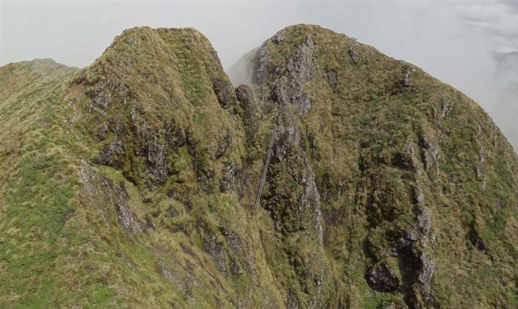
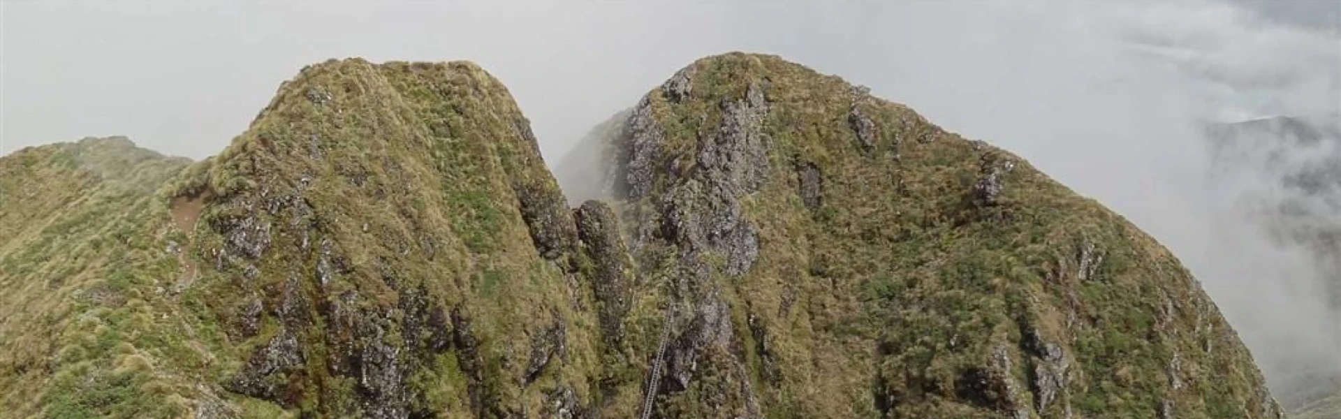
The Tararua Main Range Traverse (Putara to Kaitoke) can be tramped in sections. Putara Road End to Herepai Hut Time: 2-3 hours Distance: 5 km Track: Advanced tramping track The track begins at the end of Putara Road in Mangatainoka Valley. A swing bridge crosses the Mangatainoka River and then the track follows the true left of the river to another, larger swing bridge around 1.5 km upstream. From the top swing bridge, the track climbs steeply to Herepai Ridge. At the track junction, the track to the right leads 1.5 km to Herepai Hut. Herepai Hut to Herepai Peak Time: 1 hour Distance :1 km Track: Advanced tramping track From Herepai Hut, continue up the track to Herepai Peak. Herepai Peak to Dundas Hut (no DOC marked route) approx 4 hours There is no marked route between Herepai Peak and Dundas Hut. Terrain and route descriptions are available via some tramping clubs. Dundas Hut to Arete Hut (no DOC marked route) approx 5 hours There is no marked route between Dundas Hut and Arete Hut. Terrain and route descriptions are available via some tramping clubs. Arete Hut to Dracophyllum Hut (partially marked) Time: 2-3 hours Track: Includes Expert route and Advanced tramping track sections The route between Arete Hut and Dracophyllum Hut is currently partially marked. From Arete Hut, continue along the tops to Pukematawai. Just below the Pukematawai summit, you meet the Te Araroa track. Follow this to Dracophyllum Hut. Dracophyllum Hut to Nichols Hut Time: 5.3 km Distance: 3-4 hours Track: Advanced tramping track Continue following the track along the main range. As you approach Nichols peak the track leaves the bush. The hut is situated on a side track near Nichols peak. Nichols Hut to Anderson Memorial Hut Time: 2-3 hours Track: Advanced tramping track From Nichols Hut, continue along the main range. The route climbs to the summit of Mt Crawford, then continues on to Junction Knob. From Junction Knob, continue along the main range to Anderson Memorial Hut. Anderson Memorial Hut to Aokaparangi Hut Time: 2-3 hours Track: Advanced tramping track The track continues along the main range and leads over Kahiwiroa. It then climbs to the top of Aokaparangi. The hut is on the bush line below Aokaparangi, accessed from a track near the summit. Aokaparangi Hut to Maungahuka Hut Time: 3-4 hours Track: Advanced tramping track From Aokaparangi Hut, follow the hut access track back to the top of Aokaparangi. Continue following the track along the main range, past Wright (1196m) and Simpson (1174m). The route then climbs towards Maungahuka. The hut is situated beside a tarn near the Maungahuka summit. Maungahuka Hut to Kime Hut Time : 7-9 hours Track: Expert route As you leave Maungahuka, you'll reach an intersection that goes left down to Neil Forks or right along to the ladder. Make sure you do not take the left down to Neil Forks. It is not very well signed so check your GPS here. The actual intersection is about 50m before the intersection sign. Follow the route to the junction at Maungahuka summit, then continue on the main range route following the sign towards Kime Hut. The route passes over the Tararua Peaks. The Tararua Peaks are a notoriously steep double peak, formed by the Tuiti and Tunui summits. They are traversed with the help of a long ladder. Take great care. Turn right at the top of the ladder. After the Tararua Peaks, continue following the route over McIntosh (1286), Yeates (1205m), Vosseler (1198m) and Boyd-Wilson Knob (1138m). At Bridge Peak, the route joins the Southern Crossing route. Follow the Southern Crossing to Kime Hut. Kime Hut to Alpha Hut Time: 5–6 hours Track: Advanced tramping track The Southern Crossing route leads from Kime Hut over Field Peak to Mount Hector (1,529 m). The exposed ridge of the Dress Circle takes you to the top of Aston (1,376 m). Continue along the ridge route over Alpha (1,361 m) and descend to Alpha Hut. Alpha Hut to Kaitoke Time: 8-9 hours Track: Advanced tramping track From Alpha Hut, the track descends to the saddle at Hells Gate. The track follows Marchant Ridge, a long stretch of bush that is rough underfoot and muddy when wet. The track ends at a car park on Kiwi Ranch Road, at Kaitoke.
This is a very challenging alpine trip . You must have the fitness, experience, and skills to complete it safely. Much of the route is fully exposed to extreme, fast-changing weather . Expect low visibility, strong winds, and storms. There are unmarked sections requiring confident route finding and navigation. The terrain is steep, rugged, and narrow , with significant drop-offs . You need Excellent backcountry tramping and survival skills Strong navigation ability, including in low visibility Confidence on exposed ridges and steep terrain High fitness and good balance Knowledge of weather assessment and response A plan for alternative and escape routes Pack for an emergency Do not pack light. If injured or delayed by weather, you must be able to wait and survive until help arrives. Carry: A distress beacon and a communications device Emergency shelter Warm, waterproof clothing First aid kit Head torch with spare batteries Plenty of spare food and water Navigation aids Water There are no water sources along the main range except at huts. Weather Attempt the traverse only in good weather . Check forecasts for Kime Hut and Arete Hut , not nearby towns. Bail out points Junction Knob via Waitawaewae to Otaki Forks Kime Hut to Otaki Forks via Field Hut Terrain hazards The route includes steep, exposed sections with chains and a ladder . Some areas have fatal fall potential - extreme care is required.
Herepai Hut Dundas Hut Arete Hut Dracophyllum Hut Nichols Hut Anderson Memorial Hut Aokaparangi Hut Maungahuka Hut Kime Hut Alpha Hut
These links on Google Maps will help you find the start point at the end of Putara Road , which is around 20 minutes’ drive from Eketāhuna, and the end point, Kiwi Ranch Road , Kaitoke.
We encourage you to continue gaining the skills and knowledge required for a safe trip. The NZ Mountain Safety Council has lots of free resources and information you can use. These can be accessed via www.mountainsafety.org.nz . Level up in your outdoor knowledge with these interactive online learning tools: Trip Planning Tramping / field Skills Basic Navigation River Safety Additionally, check out the range of helpful videos available from the NZ Mountain Safety Council YouTube channel .
Dogs allowed. Keep dog under control at all times.
Track information, access and weather can change. Confirm current alerts and land-manager information close to departure, tell someone your plans, and carry equipment appropriate for the route and conditions.