11 October 2026
Showers, clearing in the afternoon but remaining mostly cloudy, with drizzle about the ranges. Northwesterlies developing in the morning.
Loading outdoor place details…
Kāpiti
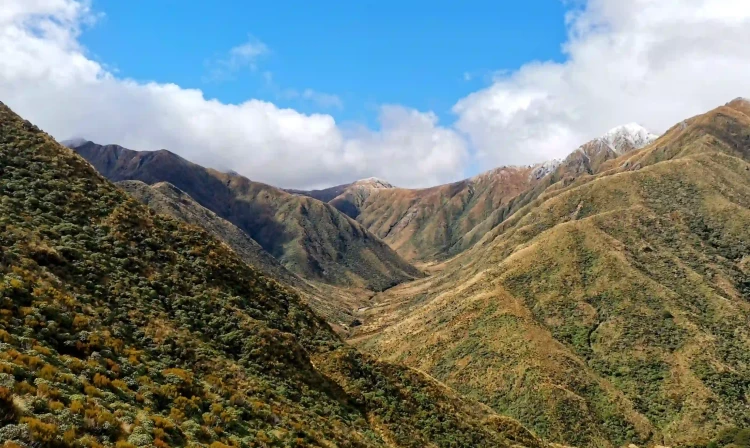
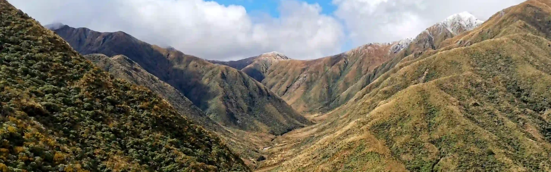
Te Araroa trail section: This section involves 3–6 days through forest and alpine terrain and includes many steep ascents and descents. It begins at 150m above sea level and reaches its highest point at Mount Crawford 1,462m. Views in the Tararua Range in clear weather are outstanding.
Distance
43 km
Walking time
3–6 days
Difficulty
Advanced
Dogs
Not allowed
Wheelchair access
Not marked friendly
Current status
Weather outlook
Issued 11 Oct 2026, 5:43 am
11 October 2026
Showers, clearing in the afternoon but remaining mostly cloudy, with drizzle about the ranges. Northwesterlies developing in the morning.
12 October 2026
Mostly cloudy with isolated showers, clearing to fine in the morning. Northwesterlies developing for a time in the morning and afternoon.
13 October 2026
Occasional rain. Northeasterlies, turning northwesterly in the morning.
14 October 2026
Showers becoming isolated with longer fine breaks in the afternoon. Northwesterlies.
15 October 2026
A few showers, some possibly heavy. Northerlies, dying out.
Regional guidance only; elevation and terrain can produce different conditions.
Explore the area
Explore the track route and surrounding area before you set out.
Warning: Weather in the Tararua Range is notorious for deteriorating rapidly. Be prepared for extreme conditions at all times. There can be gale-force winds, heavy rain, and poor visability. Snow can fall in any season. Be prepared to wait out storms or for streams to subside after heavy rain. Do not cross swollen streams. Be sure to fill in the intentions book at the start of the track. The trail is divided into three stages of 1–2 days each, depending on fitness and weather conditions. Poads Road (Levin) to Te Matawai Hut (900m), via Waiopehu Hut (960m) Te Matawai Hut to Nichols Hut (1160m) via Dracophyllum Hut Nichols Hut to Pārāwai Hut (Ōtaki Forks, Road End,100m) via Waitewaewae Hut (310m) See the note below regarding Otaki Forks Road access. If exiting from the Mangahao-Makahika Track, walk approximately 7km down Gladstone Road to Poads Road on the left, crossing an old concrete bridge and walking uphill to the car park. From Levin, take transport for 7km to the car park at the end of Poads Road. Poads Road - 2.5km Poads Road to Waiopehu Hut - 9km / 4-5hr This route to Waiopehu Hut (960m 18 bunks) involves a climb of 800m. The track starts at a DOC notice board and initially crosses private farmland. Follow the blue posts and farm track. The Ridge Track to Waiopehu Hut veers right soon after entering the bush. The track is marked through the forested areas and the alpine areas follow a very defined ridge with some marking where possible.There is a pleasant lunch spot at a clearing about half an hour before the hut. The Waiopehu Hut is at the bushline offering good views across the plains and east to Tararua high peaks. Waiopehu to Te Matawai Hut - 6km / 4hr The track climbs over Waiopehu Peak (1094m), Twin Peak (1097m), Richards Knob (985m) descends to Butchers Saddle (690m) before climbing to Te Matawai Hut. Ascent 500m, descent 600m. Climb the 100 vertical metres to the shoulder of Waiopehu Peak, then descend and climb Twin Peak (with memorial for person killed in a major storm 1936). This part of the track is in scrub, offering good views of surrounding hills. Descend through leatherwood and bush, then climb to Richards Knob where there is a track direction sign. At the intersection of Gable End and Dora Ridge Tracks, turn right (southeast) and follow Dora Ridge Track down to Butchers Saddle and up to its junction with the Yeates Track, that connects with the south branch of Ohau River. Go right (southeast) and follow up the ridge to Te Matawai Hut and helipad. Te Matawai Hut to Dracophyllum Hut - 8km / 4-5 hours This route to Dracophyllum Hut (1100m, 2 bunks) climbs Pukematawai (1432m), along the main range, over Butchers Knob (1158m) then through bush to Dracophyllum Hut. 700m ascent, 500m descent, with steep drop-offs, rocky scrambles, and enough exposure that it shouldn't be attempted in adverse weather conditions. Follow Northern Crossing Track up the ridge to shoulder of Pukematawai (sign where Main Range Track starts). Much of track is above the bushline and can be covered in snow in winter (June -September). Descend on the Main Range Track over various bumps to the bushline beyond Butchers Knob. Dracophyllum Hut is another hour away through beech forest. A small hut with 2 bunks and water tank. Dracophyllum Hut to Nichols Hut - 5km / 4 hours The route to Nichols Hut (1160m, 6 bunks) climbs Puketoro (1152m), Shoulder of Kelleher (1142m) and Nichols (1242m) (all unmarked) along the Main Ridge to Nichols Hut. There are steep drop-offs, rocky scrambles, and enough exposure that it shouldn't be attempted in adverse weather conditions. The track is mainly through bush, climbing into open at Puketoro and Kelleher (unmarked). At Kelleher Shoulder a cairn marks where the track descends down a steep tussock ridge, snaking down to bush. From here it follows an undulating ridge, finally climbing to the top of Nichols (unmarked) from where the track descends through tussock to the hut, east of the saddle. Nichols Hut to Waitewaewae Hut - 8km / 4-5 hours Route to Waitewaewae Hut (310m 16 bunks) via Mt Crawford 1462m. 380m ascent, 1240m descent. In strong winds and rain it may be necessary to stop at Nichols Hut until weather clears. This is a physically demanding section with steep and exposed ascents, and a long steep descent. Please allow enough time and energy to complete this. Follow the ridge up the summit of Mt Crawford for great views of the Tararua Range, Kāpiti Island, the coast and possibly Mt Taranaki. Descend to Junction Knob, turn right to Shoulder Knob, where the track re-enters the bush, and descends steeply to the Ōtaki River (bridged) and then Waitewaewae Hut, where there is river swimming. Waitewaewae Hut to Parawai Lodge - 10km / 4-6 hours Route to Parawai Lodge (100m altitude, 18 bunks) and Ōtaki Forks car park. 250m ascent, 460m descent. Follow the marked track down the terrace the hut is on. The main track then climbs and crosses a number of gullies and streams before the climb to the Plateau. These streams can be difficult and dangerous to cross in heavy rain. Be prepared to let levels fall during wet weather. Dry weather option: Follow the track to Ōtaki Forks for roughly 100m along the terrace then drop down the bank on the unmarked route and cross the Ōtaki River. Below here the river bends around to flow east. Cross back to the west bank on the bend and head to the orange marker by a side stream just below the long slip in the west bank. Follow the markers and track up this stream (Arapito Stream) to join the main wet weather track where it crosses Arapito Stream. This point is signposted. After crossing Arapito Stream the track climbs up the valley crossing a number of gullies before reaching the Plateau. The track crosses Plateau Stream three times in a short distance before a short 20m to 30m climb to the saddle. From here the new track heads south along the ridge, climbing gently (the map still shows the old route closed by a large slip). There are a couple of flat boggy sections on the ridge. From the ridge, the new track crosses a steep slope before dropping down to the old tram track. A well-graded track leads from here to a swing bridge over the Ōtaki River. It then climbs over a terrace on the south side of the river before dropping to Pārāwai Lodge. The carpark and road are across another swing bridge beside the Waiotauru River. If continuing on to the next section (Pukeatua) turn left at the road and continue for 2km to end of the road: camping area, and the start of Fenceline and Pukeatua Tracks. Ōtaki Township is 10km away down Ōtaki Gorge Road. Transport is recommended as the road is narrow and winding. Note: The current LINZ Topo50 maps shows Ōtaki Gorge Road terminating after Shields Flat. That is no longer correct. The road now connects to Te Araroa near Boielles Campsite.
Potential hazards Poisons and traps Farming operations – do not disturb stock River crossings – never cross flooded rivers Mud, Steep tracks with steep drop-offs Track exposed to sun, wind or cold Weather extremes – be aware of the weather forecast and be prepared to wait bad weather out if necessary.
Northern Start: Junction of Gladstone and Poads Road, Levin Southern End: Otaki Forks, Otaki Gorge Road Levin - Getting to/from the start From the north Te Araroa enters the Wellington region at Poads Road, 7 km from Levin (Taitoko). Levin has a full range of services and amenities available and is a good point for resupply Getting there/away Levin is on State Highway 1 , and on the North Island Main Trunk Line with a station used by the Capital Connection long-distance commuter train between Wellington and Palmerston North - P: 0800 801 700 InterCity - P: 04 385 0520 Rental Cars - multiple options available Ōtaki Ōtaki Forks Transport Options: Bookings Essential If exiting at Ōtaki Forks the Gorge Road is narrow and winding - not safe for walkers. Local Taxi Service - Wally (retired) Phone 06 362 6319 Paraparaumu Taxi Service - Tues,Thurs, Fridays 10am-3pm P: 0800 508 294
Before starting Te Araroa either as a through-walker of the whole country or a section walker, please register on Te Araroa website . Please also visit the website or download the app for detailed maps, trail alerts and other relevant information. This track is part of the Herenga ā Nuku Aotearoa track database. Herenga ā Nuku has maps and advice about public access to the outdoors . We encourage you to continue gaining the skills and knowledge required for a safe trip. The NZ Mountain Safety Council has lots of free resources and information you can use. You can access them at www.mountainsafety.org.nz . We recommend trying these online learning tools: Trip Planning Tramping/field Skills Basic Navigation River Safety Additionally, check out the range of helpful videos available from the NZ Mountain Safety Council YouTube channel .
Potential hazards Poisons and traps Farming operations – do not disturb stock River crossings – never cross flooded rivers Track exposed to sun, wind or cold Weather extremes – be aware of the weather forecast and be prepared to wait bad weather out if necessary Weather in the Tararua Range is notorious for deteriorating rapidly. Be prepared for extreme conditions at all times.Be prepared to wait out storms. Snow can fall in any season. Be sure to fill in the intentions book at the start of the track.
Track information, access and weather can change. Confirm current alerts and land-manager information close to departure, tell someone your plans, and carry equipment appropriate for the route and conditions.