10 October 2026
Partly cloudy with isolated showers developing in the afternoon. Northeasterlies dying out in the afternoon.
Loading outdoor place details…
Waikanae area
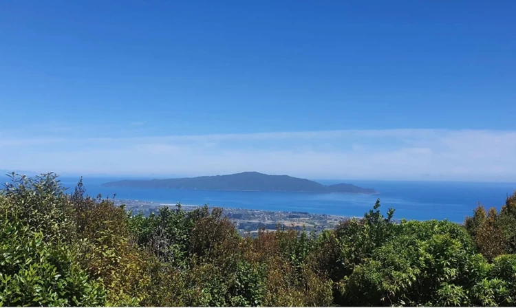
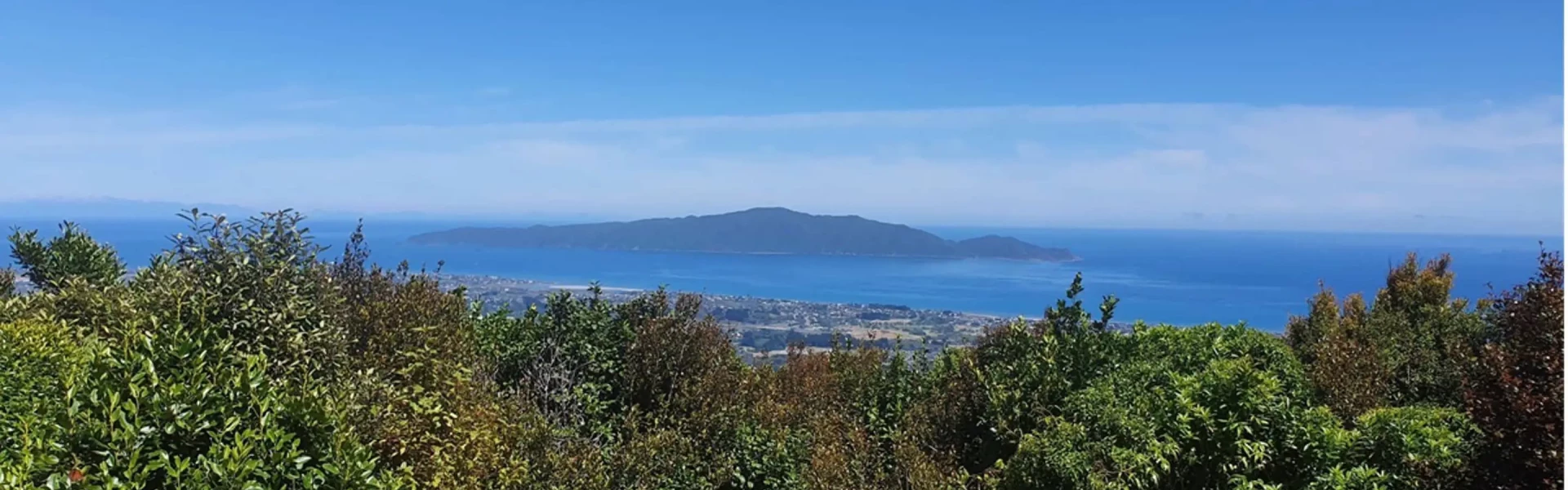
The track climbs to 521 m and offers panoramic views of the Waikanae Estuary and Kapiti Island.
Distance
6.95 km
Walking time
3 - 4 hours
Difficulty
Advanced
Dogs
On-lead only
Wheelchair access
Not marked friendly
Current status
No active alerts found. Conditions can still change, so check again before leaving.
Weather outlook
Issued 10 Oct 2026, 4:55 pm
10 October 2026
Partly cloudy with isolated showers developing in the afternoon. Northeasterlies dying out in the afternoon.
11 October 2026
Showers, clearing to fine spells early afternoon, then clouding over towards evening with drizzle on the ranges. Northerlies.
12 October 2026
Fine, then a few showers developing in the evening. Northwesterlies developing for a time in the afternoon.
13 October 2026
Occasional rain. Northeasterlies, turning northwesterly in the morning.
14 October 2026
Rain. Northwesterlies.
Regional guidance only; elevation and terrain can produce different conditions.
Explore the area
Explore the track route and surrounding area before you set out.
This challenging bush walk offers breathtaking views of Kapiti Island and the southern coastline. The walk begins at 133 Huia Street (signposted) where you cross a stile and up a narrow path between two private properties. The trail climbs through lush native bush, marked by orange triangles. While very steep and uneven, it's recommended you travel in this direction as it is easier to climb this section than descend it. There are plenty of roots and trees to use as handholds to help you as you ascend. The few windfallen trees you'll come across are either easy to clamber over or a path has been made around them. Reaching a height of 521 meters, the track then becomes less steep but still with ups and downs and roots to navigate. About an hour and a half in, the track dives down to the left, but a small trail going forwards leads to a lookout with a wooden bench provides an ideal spot to enjoy views of Kapiti Island and the South Island. Returning from the lookout, take the path down to the left. When you find yourself travelling beside a fence line, you're nearly at the next two lookouts. The first overlooks Reikorangi Valley, while the second offers views of Waikanae and Kapiti Island. At this point, the track connects to the Parata Track, leading down to Waikanae and the Tui Crescent entrance where there is a toilet. Then it's a short road walk back to the Huia St start (1.8km / 15 minutes).
By train Exit the train at Waikanae Station, walk south to Elizabeth Street, then head east towards the inland hills. It's a 2.2km walk to the Huia St entrance. Upon exiting the track in Tui St, head downhill towards the train station. By car From Waikanae township, turn east over the railway line and onto Elizabeth St, left into Seddon St, right into Ruru St, and then left into Huia St. You may want to park your car halfway between the Tui Crescent and Huia St entrances so you do not have such a long walk back at the end. Use this location on Google Maps to help find your way there.
We encourage you to continue gaining the skills and knowledge required for a safe trip. The NZ Mountain Safety Council has lots of free resources and information you can use. These can be accessed via www.mountainsafety.org.nz . We recommend trying these online learning tools: Trip Planning Tramping / field Skills Basic Navigation River Safety Additionally, check out the range of helpful videos available from the NZ Mountain Safety Council YouTube channel
Dogs on a leash only.
Track information, access and weather can change. Confirm current alerts and land-manager information close to departure, tell someone your plans, and carry equipment appropriate for the route and conditions.