10 October 2026
Partly cloudy with the odd shower, then rain developing in the evening, possibly heavy. Northeasterlies developing in the morning.
Loading outdoor place details…
Cape Reinga/Te Rerenga Wairua
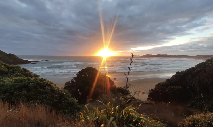
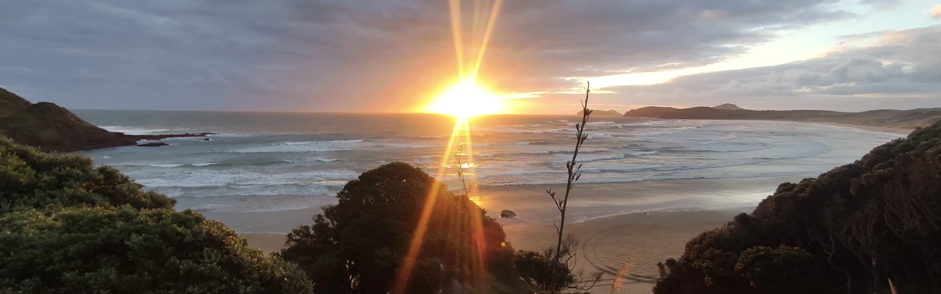
This stunning coastal track offers spectacular views of our northern coastline, regenerating bush and large wind-swept sand dunes. This track is part of Te Araroa Trail.
Distance
48 km
Walking time
4 - 5 days
Difficulty
Advanced
Dogs
Not allowed
Wheelchair access
Not marked friendly
Current status
Weather outlook
Issued 10 Oct 2026, 10:55 am
10 October 2026
Partly cloudy with the odd shower, then rain developing in the evening, possibly heavy. Northeasterlies developing in the morning.
11 October 2026
Occasional rain, clearing for a time in the morning and afternoon. Northwesterlies.
12 October 2026
Cloud clearing and becoming fine in the morning. Northerlies, turning westerly before dawn.
13 October 2026
Partly cloudy, with showers in the afternoon. Westerlies developing in the morning.
14 October 2026
Isolated showers, with increasing cloudy periods. Northwesterlies.
Regional guidance only; elevation and terrain can produce different conditions.
Explore the area
Explore the track route and surrounding area before you set out.
PLEASE CHECK THE ALERTS TAB ABOVE FOR CLOSURES The track follows the coastline from Kapowairua (Spirits Bay) on the North-eastern Coast, past Cape Reinga/Te Rerenga Wairua (where the Te Araroa Trail starts) and finishes at Te Paki Stream on the West Coast. From there, you can continue along Te-Oneroa-a-Tōhē/Ninety Mile Beach all the way to Ahipara. You can walk the whole track which is 48 km long staying at each of the four campsites situated along the track or choose one or several track sections that suit your fitness level and areas of interest. Each track section is several hours duration. The track sections from East to West are listed here. Kapowairua (Spirits Bay) – Pandora: 9 km (5.5 miles), or three hours. Pandora – Tapotupotu Bay: 9 km (5.5 miles), or five and a half hours. Tapotupotu Bay – Cape Reinga: 5 km (3 miles), or three hours. Cape Reinga – Te Werahi Beach: 2 km (1 mile), or 45 minutes. Te Werahi Beach – Twilight Beach: 7.25 km (4.5 miles), or three hours. Twilight Beach – Te Paki Stream: 11 km (7 miles), or four and a half hours.
Time: 3 hr Distance: 9km one way Kapowairua to the west end of Spirits Bay – Time: 2 hr 15 min From Kapowairua campsite you have two options: Walk along the beach, watching for the orange marker on the dunes. This indicates where to cross over to the Waitahora Lagoon and boardwalk. Follow the track behind the dunes to reach the lagoon. This path is firmer and easier to walk on than the sloping beach. Western end of Spirits Bay to Pandora – Time: 45 min Pandora is a small, secluded beach separated from Spirits Bay by a rocky headland with a basic campsite with toilets, shelter and water supply.
Time: 3 hr Distance: 9 km one way The track guides you up through vegetation, climbing steadily until you reach a junction. Here you can head towards SH1 via the Pandora Track or follow the track markers and signage towards Tapotupotu Bay. The track undulates along the top of a ridge and eventually leads you back to the coastal cliffs before you make the descent into Tapotupotu Bay. There are steep drop-offs from the track towards the ocean along this section of the track – always supervise children.
Time: 3 hr Distance: 5 km one way The track starts at the western end of Tapotupotu Bay and climbs steeply. Follow the track along the cliffs before descending into Sandy Bay. Sandy Bay is a lovely beach to stop for a snack or lunch as it is not culturally appropriate to eat at Cape Reinga/Te Rerenga Wairua.
Time: 45 min return Distance: 2 km return From the Cape Reinga/Te Rerenga Wairua Lighthouse Walk, this 2 km track heads west, leading you down past steep cliffs to the long, sweeping Te Werahi Beach. There are steep drop-offs from the track towards the ocean along this section of the track – always supervise children.
Time: 3 hr Distance: 7.25 km one way. You will find yourself traversing a vastly different landscape than in the first part of your trip along the northern coast.
Time: 4 hr 30 min Distance: 11 km one way Exit the south end of Twilight Beach following the orange markers. The track ascends above the beach and you will walk through low growing vegetation with views across Te Paki Farm. You will eventually come to a board stairway that leads you up over the dunes and down onto Te-Oneroa-a-Tōhē/Ninety Mile Beach. Follow the beach south for approximately 1 hr 30 min until you come to Te Paki Stream. This is also a popular vehicle entrance/exit to the beach so be prepared for cars and tourist buses. Turn left and follow the stream inland through the dunes for another 1 hr 30 min until you come to the Te Paki Stream parking area and toilets. The track ends here. It is approximately 9 km to Waitiki via the road from here.
This track is best suited to people with good fitness. Although this is a coastal track, it is not flat. The track is well formed or follows sections of beach with several long climbs up to ridges which go up and down over the undulations in the landscape. The track goes close to the cliff edge in places. Keep to the track and supervise children carefully. Fire is a real risk for the reserve and your safety, no fireworks, paper/sky lanterns or open fires at any time of year. Gas/contained flame cookers are permitted. Maintain a 3-metre distance between groups to reduce possible spread of fire. Always thoroughly clean your equipment (cars/shoes/camping gear etc.) before and after trips to minimise spreading invasive pests, weeds, and diseases. An intentions Book is provided at the Te Ahu Centre, Kaitaia. Feral dogs in Te Paki Recreation Reserve Feral dogs have been sighted near the Te Paki Coastal Track around Twilight Beach and Scott’s Point including 90 Mile Beach. We advise that you: do not walk the area alone do not approach any dogs do not leave food or scraps that may attract scavenging by dogs report any sightings to Far North District Council dog control 0800 920 029 if safe to do so – GPS coordinates and photos are helpful. These tracks may be closed in the future for dog control work. Lagoon entrance may block after rain Be aware the Waitahora lagoon entrance (near the eastern end of the track) blocks on occasion after heavy rain or storm events. These flood the lagoon and submerge the boardwalk. The boardwalk has marker posts which can be followed even when submerged. However it can be so flooded that the markers are not visible and is therefore unsafe to cross. There is no alternative track route when this occurs. What to bring Adequate preparation and equipment needed. Bring all the usual tramping/camping gear, and the following: tide charts - check the tide times as sections of tracks can have waves wash over them during high tides and rough seas topographical map insect repellent sunscreen/hat/sunglasses consider carrying an antihistamine/epipen as there are large numbers of wasps in places along the track and in campsites plenty of drinking water (several litres) as streams/water supplies may be dried up in summer – conserve water water filter/purification tablets or gas cooker for boiling water. Safety For your safety, note that: weather can be changeable with sudden downpours of rain increasing stream levels this may delay your progress be prepared to stay longer than intended tracks may be slippery in wet weather, and larger streams may be uncrossable you may not be able to cross some streams at around high tide and you may need to wait for the tide to recede there is limited mobile reception in Te Paki – tell someone where you are going and when you expect to be back there are plenty of mosquitoes and sandflies – make sure your tent is mosquito proof and carry insect repellent do not leave your vehicle unattended while walking the track thefts has occurred in this area the coastal areas of New Zealand is susceptible to Tsunamis, make yourself familiar with information at site and plan your escape route wasp numbers are high from January through to April, carry antihistamine cream or tablets as a precaution. Cover food and keep lids on sweet drinks. Wear light-coloured clothing as wasps are more likely to attack dark-coloured objects if their nest is disturbed beware rogue waves or ocean surges when fishing or walking near the coast. Water safety Be aware that the beaches along the track and at campsites are challenging place for swimming and can be dangerous. There are rough seas, strong currents and it gets deep quickly. The nearest surf lifesaving and coastguard stations are over an hour away, so if you get into trouble it can take a long time to get help.
Cape Reinga/Te Rerenga Wairua and Te Paki are located at the northernmost area of New Zealand. Follow State Highway 1 north from Kaitaia approximately 96 km to Te Paki and 111 km to Te Rerenga Wairua. You have vehicle access to: Kapowairua (Spirits Bay) – turn off SH1 at Waitiki Landing onto Te Hapua Road and then Spirits Bay Road, approximately 16 km. Tapotupotu – turn off SH1 2 km south of Te Rerenga Wairua follow signposts approximately 3 km of gravel road to Tapotupotu Bay. Cape Reinga/Te Rerenga Wairua – follow SH1 north. Te Paki Stream – turn off SH1 at Te Paki onto Te Paki Stream Road approximately 5 km north of Waitiki and follow 4km of gravel road to car park.
We encourage you to continue gaining the skills and knowledge required for a safe trip. The NZ Mountain Safety Council has lots of free resources and information you can use. These can be accessed via www.mountainsafety.org.nz . We recommend trying these online learning tools: Trip Planning Tramping / field Skills Basic Navigation River Safety Additionally, check out the range of helpful videos available from the NZ Mountain Safety Council YouTube channel
No dogs.
Track information, access and weather can change. Confirm current alerts and land-manager information close to departure, tell someone your plans, and carry equipment appropriate for the route and conditions.