10 October 2026
Cloudy periods, then rain developing in the evening. Northeasterlies developing in the morning.
14° / 20°
Loading outdoor place details…
Far North
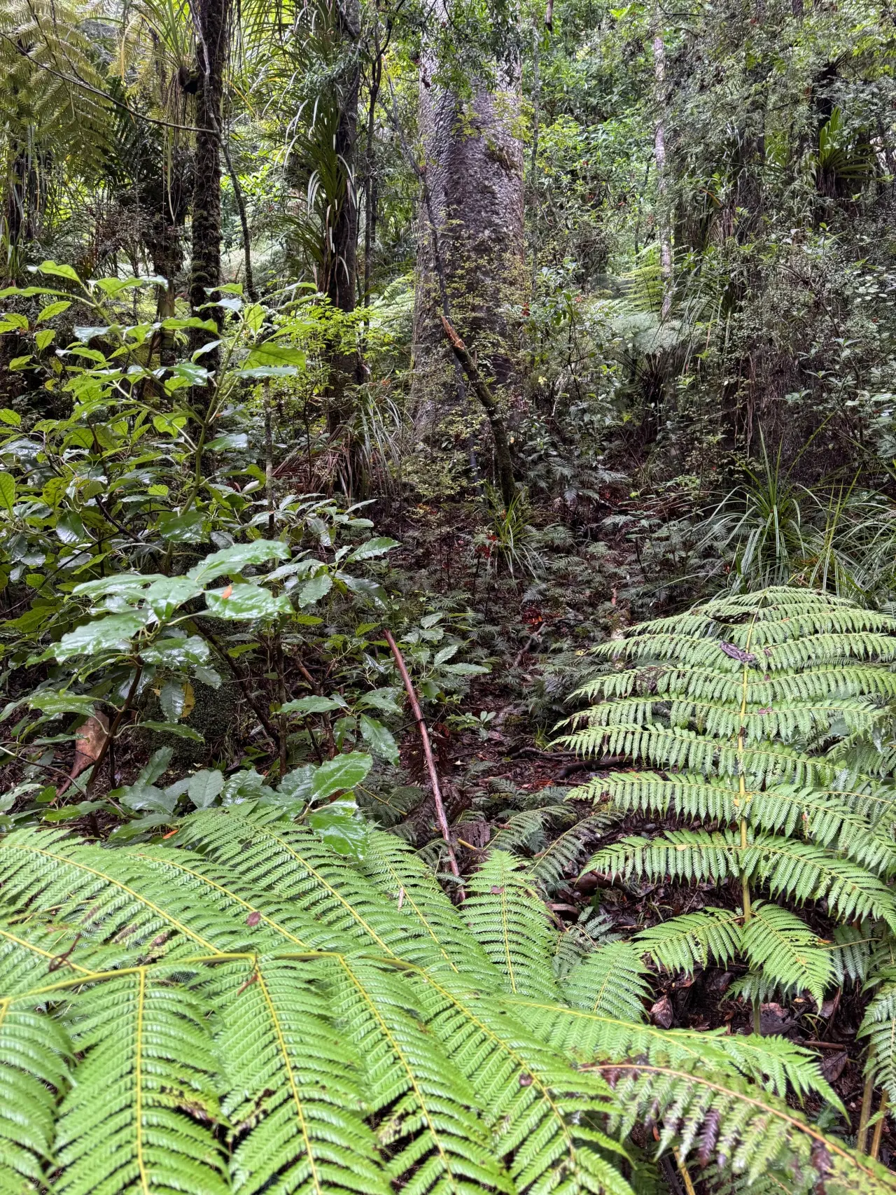
Te Araroa trail section: From Ahipara, you'll walk east to Kaitaia, then through Raetea Forest and over some of the highest peaks in Northland, then on through Ōmahuta Forest and Puketī Forest. In Raetea Forest expect a rough backcountry track, with frequent slips, damage and fallen trees Mangamuka Track is a backcountry tramping track. The track surface is rough and it is not often maintained – the track is best suited to experienced trampers who have good navigational skills. There are frequent slips, slumps in the track and fallen trees, particularly after rain or high wind. You will need to climb around or over these, there may be marked diversions. The track is best in summer. This track becomes extremely slippery, wet and muddy in winter and following heavy rain. DOC rangers recommended only walking this track in summer. For bookable DOC facilities (such as Puketi Hut / Uretiti Beach Campsite) you need to make sure that your Trail Pass and DOC Bookings account are linked – so that when you make the booking, the DOC system knows you have a Trail Pass and the discount is applied. When you registered we provided you with instructions of how to do this, to make sure you didn’t experience delays in accessing the discount on bookable facilities. If you haven’t created your DOC bookings account you must do so now. Once you have made an account, email booking@doc.govt.nz with a copy of your Trail Pass and they will connect the two. This may take 3-5 days.
Distance
99.4 km
Walking time
4–5 days
Difficulty
Advanced
Dogs
Not allowed
Wheelchair access
Not marked friendly
Current status
No active alerts found. Conditions can still change, so check again before leaving.
Weather outlook
Issued 10 Oct 2026, 7:40 am
10 October 2026
Cloudy periods, then rain developing in the evening. Northeasterlies developing in the morning.
14° / 20°
11 October 2026
A few showers. Northwesterlies.
14° / 20°
12 October 2026
A few showers. Northwesterlies.
14° / 20°
13 October 2026
Mostly cloudy, with the chance of a shower in the afternoon. Northwesterlies developing in the morning.
13° / 21°
14 October 2026
Fine, but becoming cloudy in the evening. Northwesterlies.
14° / 21°
Regional guidance only; elevation and terrain can produce different conditions.
Explore the area
Explore the track route and surrounding area before you set out.
The Herekino Forest has now closed due to Kauri Dieback. From the boat ramp on Ninety Mile Beach please follow the Ahipara road to Kaitaia( 14.5km ). Please be careful on this road. From Kaitaia, walkers may need to catch a lift. The road walk is very dangerous as it is State Highway 1 to Ruaroa Road ( 6km ). You can then walk up that road until you come to Takahue Road ( 7km ) and then walk to Takahue ( 4.3km ). Turn SE on Takahue Saddle Road for 2.5km alongside the Takahue River and keep right at the junction with Warner Rd. No camping on Warner Road beside the river please. There are no amenities at the Warner Road intersection. This is a swimming area for local children and people are understandably concerned about water pollution. There is a campsite with 1.5 km up the track, 1km before the saddle junction for Broadwood. There is no longer a toilet at this free campsite. Walkers should carry a small trowel for digging holes when required. Fortunately this is not very frequent on Te Araroa See the Food and Supply section below for a possible meal stop at 271 Takahue Saddle Rd, just before the climb to the free campsite. Raetea Forest Track - 18km / 9.5hr This DOC time estimate is low. The Raetea Forest Track may take some walkers 12 to 15 hours. From the junction with Warner Rd, go right and follow the old Takahue Saddle Road (just a track now) as it turns away from the River and climbs steeply through farmland for 2.5km. At the saddle , turn off left (east) following the orange markings up into the Raetea Forest. It's a rough climb up to the ridge and onto a 580m peak, around km 140. There is a small tent space at the summit. There is a small camping area approximately 1.5km up the hill (km 137) that may or may not have a good fresh water supply, please note that the water supply after this point is limited or non-existent. The next water supply is at Makene Road (km 155.2), 18 slow kilometres away. Hard going in muddy conditions may required two days. You will need more water than you might expect. We suggest taking 3 litres, especially if you will be cooking UPDATE 17 September 2023. This camping area provides a place for a few tents, a picnic table and a rainwater tank The toilets and shower provided by the landowner are no longer maintained and are unusable . Use a trowel and don't leave mess for others. The Raetea Forest has some of the highest peaks in Northland, so expect cloud and rain. The bush track follows the ridgeline on a largely west-east basis past: the 744m Raetea summit an unnamed highpoint of 727m (past a junction with a track leading north on a route out to SH1) the 638m Kumetewhiwhia summit the 445m Umaumakaroro summit There is space to camp beside the radio repeater, on a short spur track near Raetea summit (km 143.3). There is a camping spot near km 152.2. It is about 200 m after (southbound) a peak labelled 447m on maps. The track then descends through bush and then private farmland to Mākene Rd, Mangamuka. The exit is into the yard of a house — they are used to walkers and happy to have you pass through — a hello and/or thank you always goes down well. There are a number of working dogs here whose bark is literally worse than their bite. Walk steadily down the driveway and you'll be fine. Otherwise, and preferably, to avoid the dogs, SOBOs can follow the orange signs to the right and pass around the right side of the house. NOBOs can follow the signs to the left, and pass to the left of the house. Please leave any gates as you find them. Makene Road to Omahuta Forest Road - 13km There is a small camping area approximately halfway down Makene Rd, with toilet, river water, picnic table and washing line (km 155.3). By Donation. Walk northeast along Makene Rd to the junction with SH1. Then carefully follow SH1 south for 5.5 km, being wary of fast traffic. This takes you through Mangamuka settlement and then south to Mangamuka Bridge. From Mangamuka Bridge, continue south SH1 for almost a kilometre Turn east onto Omahuta Road and walk 5km to the junction with Jacksons Road and Omahuta Forest Roads (this connection 13km/3hr). Ōmahuta-Puketī Forest Track - 32km / 2 days Warning: Some beehives en route, poison and trapping for possums, rats and mustelids occurs within this forest. Goat control operations using contract hunters also occur within this forest. For forest hygiene and visitor safety reasons it is requested that in Ōmahuta and Puketī Forests camping is restricted to the sites recommended by DOC – those being Blackbridge Road (km 177.9) and Puketī Forest HQ (eastern edge of Puketī Forest). These sites have been identified for camping as they are away from kauri, therefore reducing the risk of spreading kauri dieback disease and will be poison exclusion zones for possum control operations. Therefore please plan around using only these two sites. From the Jacksons Road junction (km 167.3, head east on well-formed single-track forestry roads (vehicles are rare). 700m up Omahuta Forest Rd, take the left fork onto Kauri Sanctuary Rd. Keep travelling uphill for approximately another 6km past an airstrip on your left and occasional beehives tucked into the forest (just button up and walk gently past). The next major junction is where Kauri Pā Road runs off left. That’s the one to follow until turning off it onto Blackbridge Road km 174.6. Ōmahuta-Puketī Forest Track is a challenging, wet route using river canyons – subject to flash floods. You need good equipment and navigation skills. Only go in dry weather. Apple Dam campsite, which may be mentioned in older track notes and maps, is now closed because of the potential spread of Kauri Dieback disease. Camping is available 4 km further along on Blackbridge Road Follow along to cross a concrete ford over a stream (NB: if water is flowing over the top of it, do not proceed as this means water levels in the Mangapukahukahu gorge will be too dangerous). Then climb a further 1.5km until, at the top of the climb, a 4WD track leads left along a soft ridge leading down to Mangapukahukahu Stream. The track is easy to follow down, past two old forestry skid sites. At the second/lower one, a track goes through the pampas grass on the right-hand side. It leads to a rough track (with orange markers) down through trees to the Mangapukahukahu Stream. There is a new basic DOC campsite with shelter, water tank and toilet on Blackbridge Road at km 177.9, after the ford and just before the track down to Mangapukahukahu Stream. No fires allowed at Blackbridge Camp The stream runs through a gorge and is subject to flash floods in heavy rain. Do not try to go further if there is heavy rain in the region. Return back to the wet weather bypass around the north of the forest. As long as the weather is clear, walk SE criss-crossing between shoal banks in the stream for 2.5km until meeting up with the Waipapa River. Immediately south (right) of the junction between Mangapukahukahu Stream and the Waipapa River, a track leads up the bank on your right and descends to a shoal where there's a shallow crossing of the main river. This short track can be difficult to spot. It is on the right bank of the stream just before it joins the river. A short but very muddy climb up the far bank meets up with the Lower Waipapa River Track. It was upgrade three years ago and was well marked but has suffered some damage in storm conditions in early 2023. The undulating track can be slippery and arduous in wet conditions Walk 2.5km northeast to the streamside junction with the Pukatea Ridge Track. (The alternative is to try wading between shoal banks in/out of the Waipapa River but there are some deep sections). The Pukatea Ridge Track climbs steeply, (past a small freedom campsite 30m up the track) and then on up steps to the ridge through young kauri for 3.5km to meet the Takapau Track. From the junction of Pukatea Ridge and Takapau Tracks, head northeast for 300m to the junction with Walnut Track and Pirau Ridge Road (a well-formed 4WD road). Follow Pirau Ridge Road east for 9 km to the Puketī Forest Headquarters, Waiare Rd. There's a campsite here. Take care on Pirau Ridge Road as vehicles and cyclists also use this road. Ōmahuta-Puketī Wet weather bypass If recent heavy rain makes the Mangapukahukahu Stream section unsafe walk past the Blackbridge Road junction at km 174.6, stay on Kauri Pa Road and follow the Omahuta-Puketi Forest Bypass route marked on Map 11 for 31 km to reach Waiare Road, near to Puketi Forest HQ at km 198.4. There is a possible camping spot at Louie's Stream. It's at km 8 km along the bypass route In extreme conditions, it is possible to bypass the Ōmahuta-Puketi Forest Track completely and walk along the public roads south of the forests. This long road alternative is rarely used. Continue south (from Omahuta Road turnoff) on SH1 for 22km, turn left into Puketi Road and walk for 9km and Puketotara Road for 2km, then turn left up Mangakaretu Road to rejoin Te Araroa at km 205.4.
Track standard: tramping track Potential hazards Vehicles on road or track. Take care walking on roads, particularly SH1 When road walking, walkers should should wear high visibility clothing or accessories, not wear any earbuds, and remain vigilant for traffic. Walk on the right side of the road, facing oncoming traffic, where possible. Poisons and traps River canyons - flash floods. Use bypass in times of heavy rain. River crossings - Never cross flooded rivers. Small stream crossings Weather extremes Few water sources - carry plenty of water, refill whenever you can. Steep drop-offs. Bush track can get muddy and slippery so take care.
Northern Start: Boat ramp, Kaka Street, Ahipara Southern End: Puketī Recreation Centre, Waiare Road Some local accommodation places will provide transfers. Ask when you book. Peter Griffiths of Takahue - Can provide a drop-off and pick up service for a small fee and some backpacker accommodation is available. Contact him in advance on P: 09 408 3685. Local guide Roger Gale - P: 09 409 3807 - E: roger@treeskills.co.nz - is available for guiding through Raetea Forests
Far North i-SITE Visitor Information Centre - Te Ahu, Corner Matthews Avenue and South Road, Kaitaia - P: 09 408 9450 - E: kaitaia@visitnorthland.co.nz Before starting Te Araroa either as a through-walker of the whole country or a section walker, please register on Te Araroa website . Please also visit the website or download the app for detailed maps, trail alerts and other relevant information. This track is part of the Herenga ā Nuku Aotearoa track database. Herenga ā Nuku has maps and advice about public access to the outdoors . We encourage you to continue gaining the skills and knowledge required for a safe trip. The NZ Mountain Safety Council has lots of free resources and information you can use. These can be accessed via www.mountainsafety.org.nz . We recommend trying these online learning tools: Trip Planning Tramping/field Skills Basic Navigation River Safety Additionally, check out the range of helpful videos available from the NZ Mountain Safety Council YouTube channel .
Local iwi know Herekino Forest as Orowhana, and the Herkino Saddle as Te Arai (the door) where spirits pause before fleeing north to Cape Reinga. Poupou totems mark the sacred site and the central pou is carved in honour of Taunaha, an ancestor. The Herekino (Orowhana) Track was a project between Te Araroa Trust and the Department of Conservation. Te Araroa Trust also thanks the assistance given by the people of Whakamaharatanga Marae, also Te Runanga o Te Rarawa, and the Herekino Landcare Group in establishing the main track. Two other DOC tracks diverge from the Herekino Forest track - a tramp from Herekino Saddle through to the Kaitaia-Awaroa Road via Pukepoto Access Road takes 6.5hrs, and the tramp through to Larmer Road end, via the Kaitaia Walkway takes 11 hours.
Track standard: tramping trackPotential hazards Vehicles on road or track. Take care walking on roads, particularly SH1 Poisons and traps Forestry operations. Take care between Diggers Valley Road and Waiotehue Road. River canyons - flash floods. Use bypass in times of heavy rain. River crossings - Never cross flooded rivers. Small stream crossings Weather extremes Few water sources - carry plenty of water, refill whenever you can. Steep drop-offs. Bush track can get muddy and slippery so take care.
Track information, access and weather can change. Confirm current alerts and land-manager information close to departure, tell someone your plans, and carry equipment appropriate for the route and conditions.