10 October 2026
Cloudy wish showers increasing this afternoon, mainly inland where some may be heavy and thundery. Northeasterlies developing this morning.
Loading outdoor place details…
Lyell area
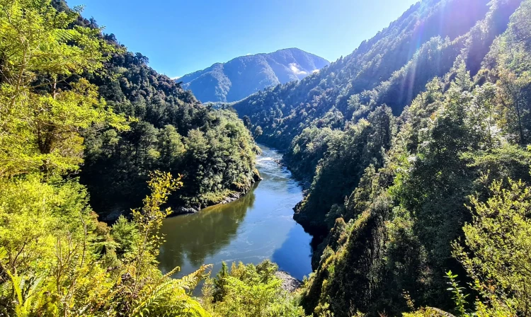
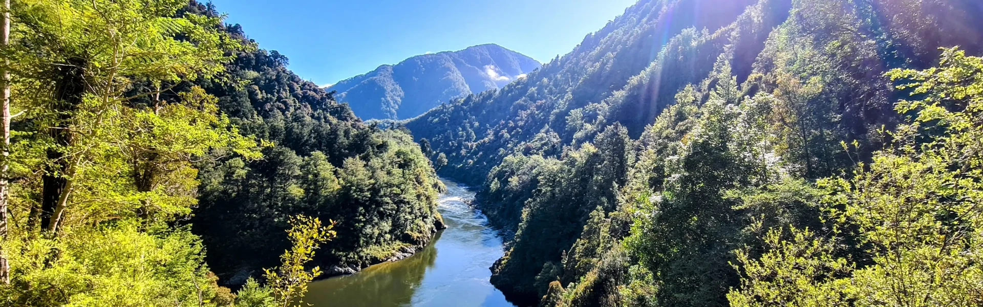
This old gold miners' road is being revived as a tramping and mountain biking track. It traverses native forests, tussock tops, river flats and valleys with stunning views of the magnificent Mōkihinui Gorge and surrounds.
Distance
85 km
Walking time
4 - 5 days
Difficulty
Advanced
Dogs
Not allowed
Wheelchair access
Not marked friendly
Current status
Weather outlook
Issued 10 Oct 2026, 4:55 pm
10 October 2026
Cloudy wish showers increasing this afternoon, mainly inland where some may be heavy and thundery. Northeasterlies developing this morning.
11 October 2026
Showers, possibly heavy, easing in the afternoon, clearing early evening. Northerlies, turning westerly in the afternoon, easing in the evening.
12 October 2026
Mainly fine, rain at night. Northwesterlies developing for a time in the afternoon.
13 October 2026
Occasional rain. Light winds.
14 October 2026
Rain with heavy falls, easing in the evening. Northerlies, dying out in the morning.
Regional guidance only; elevation and terrain can produce different conditions.
Explore the area
Explore the track route and surrounding area before you set out.
Follow the forgotten 19th century county dray road as it winds its way towards the Lyell Saddle and Lyell Saddle hut (885 metres above sea level). Beech forest dominates. Camping is possible at Lyell Campsite. Book on DOC’s website. Lyell Saddle Hut has ten bunks, a rain-fed water supply (off the hut roof), internal sink, cutlery, crockery, cooking pots, gas cook tops, a frying pan, kettle and a coffee plunger, communal living area, wood stove, outside composting toilet, bike storage and a bike repair station.
From Lyell Saddle Hut continue another 6 km through cloud forest up to the tussock tops of the Lyell Range. Then it’s 6 km of relatively level open-tops travel to ‘Ghost Lake’ and the stunning Ghost Lake Hut. Unparalleled views of pure South Island majesty are yours with every stride. Note: there is no water available between huts once on the alpine tops. Fill up at each hut and carry sufficient supplies. Take your time and enjoy the scenic stopping points. Ghost Lake Hut has eighteen bunks, a rain-fed water supply (off the hut roof), internal sink, cutlery, crockery, cooking pots, gas cook tops, a frying pan, kettle and a coffee plunger, communal living area, wood stove, outside composting toilet, bike storage and a bike repair station.
Two sharp descents and ridge travel mark this day and it’s predominantly downhill (800 metres of altitude loss) all the way to Stern Valley Hut. There is no water in this section until Stern Creek is reached. Carry sufficient supplies. Prepare yourself for the Dr Seuss-like ‘Skyline Steps’ at the end of Skyline Ridge. Stern Valley Hut has ten bunks, a rain-fed water supply (off the hut roof), internal sink, cutlery, crockery, cooking pots, gas cook tops, a frying pan, kettle and a coffee plunger, communal living area, wood stove, outside composting toilet, bike storage and a bike repair station.
With various destination options this day (including intermediate but more basic hut sites at Goat Creek and Mokihinui Forks), it’s on up Earnest Valley (north branch of Stern Creek) and through the strange but gorgeous open meadows of its catchment. Stern Creek Hut to Goat Creek Hut: 14 km; 3-4 hours. From Stern Valley Hut the trail meanders on up through the interesting Ernest Valley, a tributory of Stern Creek. Some 'earnest' climbing is again required to get over the saddle that allows passage into the Goat Creek catchment and on down to the confluence with the Mōkihinui River South Branch. Note that Goat Creek must be forded to reach the hut. This crossing may be hazardous or impassable in times of elevated creek flow or flood. Goat Creek Hut is a basic four-bunk hut. It is free to stay, and bookings are not required. Goat Creek Hut to Specimen Point Hut: 11 km; 3-4 hours. From Goat Creek Hut it’s 8 km of flat walking down through the beautiful podocarp forest of the Mokihinui River South Branch to the Mokihinui Forks Hut (2 -3 hours). Mokihinui Forks Hut has ten bunks and is a basic hut with heating and a non-flush toilet. It is free to stay, and bookings are not required. From there it is a further 3 km, 1 – 1.5 hours down to the Specimen Point Hut settlement at the head of the mighty Mokihinui River Gorge. Specimen Point Hut has fourteen bunks, a rain-fed water supply (off the hut roof), internal sink, cutlery, crockery, cooking pots, gas cook tops, a frying pan, kettle and a coffee plunger, communal living area, wood stove, outside composting toilet, bike storage and a bike repair station.
From Specimen Point Hut, the Mōkihinui Gorge shows the way to the sea. The Old Ghost Road picks up the old miners’ track hugging the true left bank of the mighty Mokihinui River gorge with stunning river views and a virtually flat journey out to Seddonville.
The Old Ghost Road traverses rugged and remote terrain ranging in altitude from near sea-level to more than 1300 metres. Weather can change very quickly and should never be taken for granted. Before embarking on your journey, check the most up-to-date forecasts. For more information, visit the Old Ghost Road website .
Bookings are required for the huts managed by the Mokihinui Lyell Backcountry Trust: Lyell Saddle , Ghost Lake , Stern Valley and Specimen Point huts. They each have a rain-fed water supply (off the hut roof), internal sink, cutlery, crockery, cooking pots, gas cook tops, a frying pan, kettle and a coffee plunger, communal living area, wood stove, outside composting toilet, bike storage and a bike repair station. Each of these huts also has one tent site available. Book on the Old Ghost Road website . Bookings are not required for Goat Creek and Mokihinui Forks huts, which are managed by DOC and are available on a first come basis. They are basic huts, so do not have the amenities that the other huts have. Lyell Campsite , at the start of the track, must be booked.
The southern end of the Old Ghost Road starts at the Lyell Conservation Campsite (State Highway 6) in the Upper Buller Gorge, a 50-minute drive from Westport. Use this location in Google Maps to find your way there. The northern end of the Old Ghost Road finishes at Seddonville, 50 km north of Westport on State Highway 67.
We encourage you to continue gaining the skills and knowledge required for a safe trip. The NZ Mountain Safety Council has lots of free resources and information you can use. These can be accessed via www.mountainsafety.org.nz . We recommend trying these online learning tools: Trip Planning Tramping / field Skills Basic Navigation River Safety Additionally, check out the range of helpful videos available from the NZ Mountain Safety Council YouTube channel .
No dogs.
Track information, access and weather can change. Confirm current alerts and land-manager information close to departure, tell someone your plans, and carry equipment appropriate for the route and conditions.