10 October 2026
Cloudy, then showers from afternoon, possibly heavy and thundery with hail.
Loading outdoor place details…
Arthur's Pass National Park
This classic summer tramp for experienced backcountry trampers crosses Harman Pass, Whitehorn Pass and Browning Pass/Noti Raureka. It gives the excitement, variety and contrast of a transalpine route.
Distance
55.8 km
Walking time
4 - 5 days
Difficulty
Expert
Dogs
Not allowed
Wheelchair access
Not marked friendly
Current status
The track to Carrington Hut has been cut off by the Waimakariri River 2 km upstream from Anti Crow Hut. It is still marked on the topographic maps but is now impassable. You will need to cross the Waimakariri River at least two times before rejoining the track. This river crossing is always difficult. Be prepared to turn back.
Weather outlook
Issued 10 Oct 2026, 7:33 am
10 October 2026
Cloudy, then showers from afternoon, possibly heavy and thundery with hail.
11 October 2026
A few showers, clearing in the evening.
12 October 2026
Fine.
13 October 2026
Showers.
14 October 2026
Heavy rain easing.
Regional guidance only; elevation and terrain can produce different conditions.
Explore the area
Explore the track route and surrounding area before you set out.
Time: 4–5 hours one way Take the Carrington Hut Route to reach Carrington Hut.
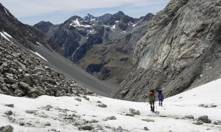
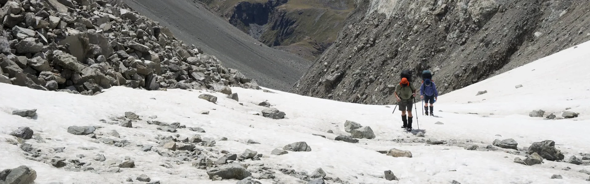
Time: 9–10 hours one way This section crosses both Harman and Whitehorn passes, as outlined below. It can be completed over two days by camping at Harman Pass, where a suitable tent site is located near Ariels Tarns - this is the only suitable site for camping. Carrington Hut to Harman Pass Time: 3 hours one way From Carrington Hut, follow the track to the White River riverbed and continue upstream. You'll need to find a safe crossing point to reach the Taipoiti River on the opposite bank— the Clough Cableway has been removed , and the White River is only crossable during low flows. If there’s snow in the Taipoiti valley, conditions can be challenging. In winter and spring, avalanches may funnel down from the cliffs above the gorge. Harman Pass to Whitehorn Pass Time: 2 hours one way Warning: Do not attempt this section in poor visibility—Whitehorn Pass is only clearly visible on a fine day. Harman Pass is a junction for those heading down Mary Creek to Julia Hut, but continue on the marked route to Ariels Tarns. A poled track climbs above Mary Creek, sidling across tussock and rocky shelves to the first of the tarns. Pass the tarns, then follow markers past a small rock hump and into rocky terrain. The poled route ends at the base of permanent snow and ice. From here, pick your own way up the valley to the pass. Near the top, angle right to a cairn and marker on the saddle. Note: The permanent ice field may contain crevasses, especially in late summer. If snow is deep or unstable, turn back. Whitehorn Pass to Park Morpeth Hut Time: 4–5 hours one way Warning: The steep descent from Whitehorn Pass is avalanche-prone. From the pass, descend carefully via the zigzagging worn route on the true left—this is the safest way through the bluffed terrain. Avoid dislodging loose rock onto others. Once near the valley floor, follow the true left of Cronin Stream. Terraces may provide easier travel. Lower down, cross to the true right at a suitable spot. Just before the stream enters a gorge, look for orange markers or a large cairn at the base of a scree slope. Sidle across the slope at the level of the cairn to join a worn track marked with poles and cairns. This leads across a side creek and scrubby spur, then drops to a boggy terrace with small tarns. Skirt around the tarns to avoid damaging fragile bog vegetation, then descend toward the Cronin Stream–Wilberforce River confluence.
Park Morpeth to Browning Pass/Noti Raureka Time: 2 hours one way This is the steepest section of the Three Passes route. From Park Morpeth Hut, follow the true left of the Wilberforce River. After it joins with Hall Creek opposite Clough Memorial, ford the river. Begin the climb up the zigzag track to Browning Pass / Noti Raureka. Before the zigzag disappears into bluffs, leave the old route and climb the obvious scree slope—there’s often a worn trail in summer. Near the top, the scree narrows and steepens. Move carefully onto the rock and tussock to the left, where markers guide you through the final bluff section to the pass. Warning: In winter and early spring, snow and ice can significantly increase the difficulty. A cornice at the top is possible. All party members must be capable of self-arrest. Once on Browning Pass, the steepest part of the journey is behind you. Browning Pass/Noti Raureka to Harman Hut Time: 3 hours one way Browning Pass to Harman Hut From Browning Pass / Noti Raureka, a poled track leads around the western edge of Lake Browning / Whakarewa and continues over gentle, boggy uplands. The route then descends to the upper Arahura River. Locate the benched track on the river’s true right, then cross the river to reach it . It is important to cross here—do not attempt to follow the true left, as it soon becomes impassable due to waterfalls, bluffs, and dense scrub. Once on the true right, follow the benched track downstream. Be aware of three avalanche chutes crossing this section— from late July to the end of November, take extra care and avoid stopping in these zones . The track ends at a side creek with steep gravel banks, near the Arahura. Drop to the riverbed and cross to the true left. Continue downstream until you reach a large orange triangle marking the next section of track. Follow this to a small side stream, head 100 m upstream, and look for a wide grassy track on the true left— do not miss this turnoff . From here, it’s a 20-minute walk to Harman Hut.
Time: 3–4 hours one way From Harman Hut, follow the track to a swing bridge and cross to the old benched track running high above the Arahura River. Watch for the clearly signposted turn-off to Styx Saddle, marked by large poles across the boggy terrain. After crossing the saddle, the track resumes at the bush edge and follows the true right of the Styx River. This section is wet and slippery, with moss and lichen-covered rocks—take care. Twisted rātā trees are a standout feature in this area. A few minutes after the track emerges onto Grassy Flat, cross the Styx River to the true left, following orange markers. Grassy Flat Hut is located in the middle of the flats on the true left bank.
Time: 1 hr 30 mins From Grassy Flat Hut, head downstream and re-cross the Styx River. The track begins on the true right, just below a prominent flat covered in toetoe (a tall native grass similar in appearance to pampas). Follow the true right of the river for about an hour. A sign marks the descent to the river and the route to Mid Styx Hut. You'll need to cross to the true left to continue—but the exact crossing point can vary 100–200 m up or downstream from the sign, depending on river conditions. After crossing, you may also need to ford a large side creek before picking up the route. The track then climbs steeply onto a terrace. After about 30 minutes, you'll reach Mid Styx Hut.
Time: 2 hr 30 mins – 3 hours From Mid Styx Hut, follow the route along the terrace for about 30 minutes before descending steeply into Tyndall Creek. This section is exposed in places—take care. Cross Tyndall Creek to the true left and continue for just over a kilometre to reach the Styx River. From here, follow the true left downstream before crossing the Styx again to join an old farm track. This leads directly to the car park at Lake Kaniere Road.
What to Expect: This is a demanding alpine route with multiple major river crossings, very steep terrain, and permanent snow on Whitehorn Pass. You must carry an ice axe and crampons—and be skilled in using them. Browning Pass / Noti Raureka is especially steep and can be icy year-round. Experience Required: Only suitable for well-equipped, experienced backcountry trampers with alpine skills and gear. This is not a route for beginners. Best Season: Mid to late summer (January–February) offers the most stable conditions. This route is not suitable in winter due to avalanche risk and snow-covered terrain. Maps Required: NZTopo50: Otira BV20, Kaniere BV19 Hazards: Avalanches, rockfall, steep ice slopes, flooded rivers, and rapidly changing alpine weather. Before setting out, check the latest track conditions and avalanche advisory with the Arthur's Pass Visitor Centre. Avalanches usually occur from May to November in Arthur’s Pass National Park. There can also be avalanches outside this period, if there is still snow coverage.
Carrington Hut Park Morpeth Hut Harman Hut Grassy Flat Hut Mid-Styx Hut
Use these links on Google Maps to help you find your way to the eastern starting point on the O'Malleys Track to Carrington Hut , beside State Highway 73 (SH73), 10 km east of Arthur's Pass village. On the western side, access to the ends of the Arahura or Styx river track is via Lake Kaniere Road, inland from Hokitika.
We encourage you to continue gaining the skills and knowledge required for a safe trip. The NZ Mountain Safety Council has lots of free resources and information you can use. These can be accessed via www.mountainsafety.org.nz . We recommend trying these online learning tools: Trip Planning Tramping / field Skills Basic Navigation River Safety Additionally, check out the range of helpful videos available from the NZ Mountain Safety Council YouTube channel
No dogs.
Track information, access and weather can change. Confirm current alerts and land-manager information close to departure, tell someone your plans, and carry equipment appropriate for the route and conditions.