09 October 2026
Fine, then low cloud or fog at night. Southerlies dying out early evening.
8° / 19°
Loading outdoor place details…
Southland District
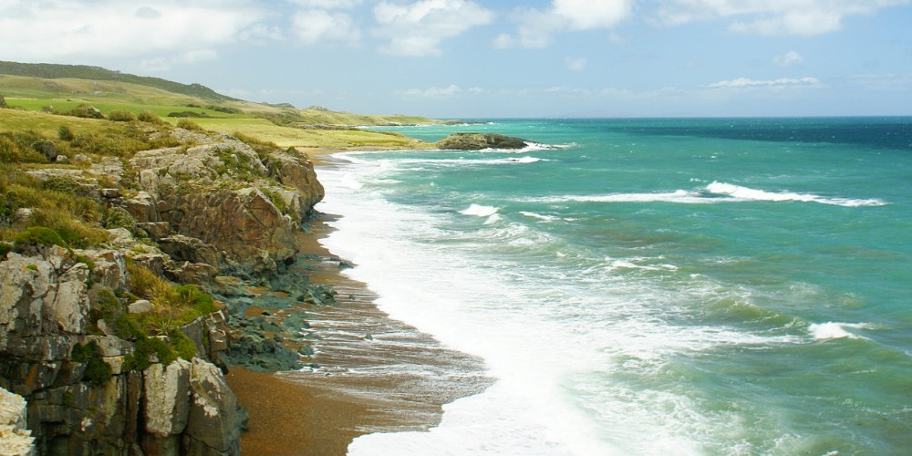
Te Araroa trail section: This coastal track connects Colac Bay with Riverton and is mostly near the coast. There is a lambing season bypass and an alternative high-tide route.
Distance
12.5 km
Walking time
4 hours
Difficulty
Easy
Dogs
Not allowed
Wheelchair access
Not marked friendly
Current status
No active alerts found. Conditions can still change, so check again before leaving.
Weather outlook
Issued 9 Oct 2026, 5:17 pm
09 October 2026
Fine, then low cloud or fog at night. Southerlies dying out early evening.
8° / 19°
10 October 2026
Low cloud or fog in the morning and again at night, otherwise partly cloudy with the odd shower. Easterlies for a time in the afternoon.
9° / 21°
11 October 2026
Fine, but becoming cloudy in the evening. Northerlies, turning southwesterly in the afternoon.
8° / 21°
12 October 2026
Fine. Northwesterlies developing in the morning.
10° / 22°
13 October 2026
A few showers becoming widespread in the afternoon. Northwesterlies, dying out in the evening.
8° / 20°
Regional guidance only; elevation and terrain can produce different conditions.
Explore the area
Explore the track route and surrounding area before you set out.
Before the climb up to Mores Reserve the track crosses sections of private farmland. Keep to the marked track here and be aware that this section is closed during September and October for lambing. It is also foot access only and dogs are prohibited. Lambing season bypass: To reach Riverton during the lambing closure, 1st September to 31st October, continue on Tīhaka Beach Road to Orepuki Riverton Highway (SH99). Turn right here and walk the road shoulder into Riverton. Colec Bay to Palmerston Road Bridge - 13km The track formally begins at the Colac Bay Road/SH99 junction (with the Colac Bay Tavern and campground adjacent). If the tide is right, head east along the beach. Alternatively, at high tide, walk the initial section on the Foreshore Road frontage then descend to the beach when the road turns inland. Continue along the beach then ascend the formed sand track to Tīhaka Beach Road. When this road veers inland Te Araroa remains on the coast (unless you’re here during the lambing closure). Keep to the track, which follows marker poles along the beaches and across the headlands. From the final deer fence the track leaves the coast and heads up towards, then through, Mores Reserve to emerge at a car park at the end of Richard Street. There are public toilets here. Walk down Richard Street towards Riverton. At the bottom of Richard Street turn left onto Bay Road and walk around to the Palmerston Road Bridge. The Tihaka Beach Track ends at the junction with SH99 just before the bridge.
Lambing season bypass 1st September to 31st October. Foot access only. No dogs are permitted. Potential Hazards: Vehicles on road or track Take care when walking along roads Farming operations Tides, waves & rivers - safer at low tide Small stream crossings Track exposed to sun, wind or cold Weather extremes Few water sources
Northern Start: Junction of Colac Bay Road and SH99, Colac Bay Southern End: Junction of SH99 and Bay Road, Riverton
Riverton General information Te Hīkoi and Riverton Visitor Information Centre - 172 Palmerston St, Riverton - P: 03 234 8260 or 0800 834 4564. E: tehikoi@xtra.co.nz Before starting Te Araroa either as a through-walker of the whole country or a section walker, please register on Te Araroa website . Please also visit the website or download the app for detailed maps, trail alerts and other relevant information. This track is part of the Herenga ā Nuku Aotearoa track database. Herenga ā Nuku has maps and advice about public access to the outdoors . We encourage you to continue gaining the skills and knowledge required for a safe trip. The NZ Mountain Safety Council has lots of free resources and information you can use. These can be accessed via www.mountainsafety.org.nz . We recommend trying these online learning tools: Trip Planning Tramping/field Skills Basic Navigation River Safety Additionally, check out the range of helpful videos available from the NZ Mountain Safety Council YouTube channel .
Before the climb up to Mores Reserve the track crosses sections of private farmland. Keep to the marked track here and be aware that this section is closed during September and October for lambing. To reach Riverton during the lambing closure, continue on Tihaka Beach Rd to Orepuki Riverton Highway (SH99). Turn right here and walk the road shoulder into Riverton.Foot access only.No dogs are permitted.Potential Hazards:Vehicles on road or track Take care when walking along roads Farming operations Tides, waves & rivers - safer at low tide Small stream crossings Track exposed to sun, wind or cold Weather extremes Few water sources
Track information, access and weather can change. Confirm current alerts and land-manager information close to departure, tell someone your plans, and carry equipment appropriate for the route and conditions.