11 October 2026
Showers, clearing in the afternoon, but some cloud remaining about the tops.
Loading outdoor place details…
Mount Aspiring National Park
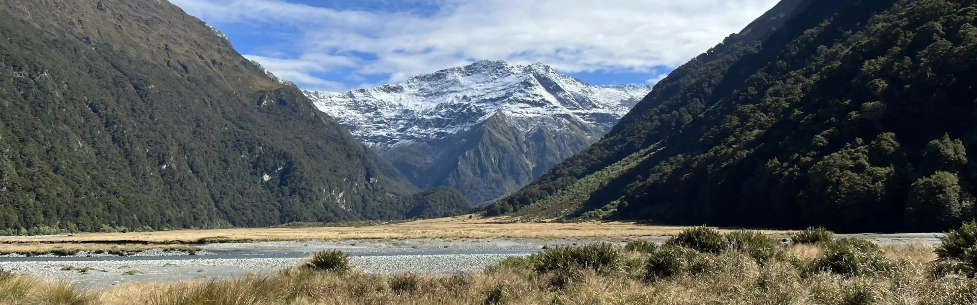
These tracks follow the upper reaches of the Wilkin Valley and can be treated as a separate tramping trip or connect with, say, the Gillespie Circuit. It can also lead to a route to the Matukituki Valley.
Distance
32.3 km
Walking time
4–5 days
Difficulty
Advanced
Dogs
Not allowed
Wheelchair access
Not marked friendly
Current status
Weather outlook
Issued 10 Oct 2026, 9:23 pm
11 October 2026
Showers, clearing in the afternoon, but some cloud remaining about the tops.
12 October 2026
Fine, but becoming overcast at night.
13 October 2026
Showers turning to heavy rain. Snow lowering to 2500 metres.
14 October 2026
Heavy rain easing to showers. Snow to 2200 metres.
15 October 2026
A few showers.
Regional guidance only; elevation and terrain can produce different conditions.
Explore the area
Explore the track route and surrounding area before you set out.
Time: 4–5 hr Distance: 15 km There is public access to the Wilkin Valley Tracks through Mt Albert Station at the end of Wilkin Rd. Some farm gates may be closed but not locked. The track starts by crossing the Makarora river, over a fence and onto a poled farmland track. The river bank is quite eroded at the farm entry point so you might have to scramble a bit. There are several small streams across the farm that are usually boggy as the cows have access to these. Once on the other side of the electric fence, the forest track begins. If the Wilkin River is low and is safe, stay on the river bed for as long as possible. The track through the forest is well marked but is a constant up and down and often a scramble where you’ll have to navigate fallen trees and rocks, mud, slippery rocks and roots. You might find cows and what comes with them well into the forest track and on the river bed all the way up to Kerin Forks hut. The track goes out of the forest and onto the river bed a few times before reaching Dans Flat and later Kerin Forks grass flats. Going is easier on the flats but there are very few trees so it can get quite hot with no shade. Walking close to the river provides with plenty of opportunities to refill with water. Reaching Kerin Forks Hut requires crossing the Wilkin River once or twice at the current river configuration.
Time: 6 to 8 hr Distance: 15 km The Wilkin Valley track between Kerin Forks to Top Forks Hut is in better condition than the previous section. It starts right beside the hut and is longer but well signposted. The first part is a beautiful forest track with little scrambling. You will find some steeper sections and a couple of wooden bridges. At the moment, there are some active streams and plenty of dry ones. The forest thins out a few times with less tree cover and steeper drops into easy rock-hopping stream crossings. The track comes out of the forest and goes over Wonderland grass flats before returning to the forest for another while before reaching Jumboland flats. At this point you’ll have two options: a poled high-water route on the true right of the river that is overgrown, boggy, eroded and that climbs a 100m hill before reaching the hut, or, an unmarked river bed route on the river true left. This route will require you to cross the river at least twice. First to get to the true left river bank and then again towards the flats close to the hut. You might be able to find old footprints to follow and a faint path through grassy areas that go around a couple of small bluffs.
Times: Lake Diana: 1 hr Lake Lucidus: 1 hr 30 min Lake Castalia: 3–4 hr Start early as this is a big day trip. The track starts by crossing the Wilkin River South Branch close to the hut. It goes over some grassy flats and small stream beds until it crosses a bigger fast flowing side stream. The track then enters the forest and steeply climbs a spur until it reaches the Disappearing Lake, a curious landscape formation where big sharp-angled boulders stick out from the dry lake bed. A few minutes later, before the start of the boardwalk, Lake Diana can be seen from a distance. There is no obvious formed track to this lake and it’s easy to miss if you’re not paying attention. The boardwalk takes you over a swampy area to where the track splits into two. Towards the left, you’ll reach Lake Lucidus after about 15 minutes. Its impressive moraine wall, milky blue water and shallow outlet are worth visiting. Towards the right, the track takes you to Lake Castalia which you’ll reach about 2h later. You’ll be crossing the Lucidus outlet once and Wilkin River North Branch twice. The track is poled and slow going, climbing through overgrown alpine vegetation, going up and down on a narrow ledge that can be slippery in the wet. After the last river crossing the poled faint track keeps climbing through overgrown snow grasses until the terrain becomes increasingly rocky. From here, cairns lead the way hopping over big sharp boulders first, loose smaller rocks later. The last few hundred metres towards the outlet are on a narrow slippery ledge. Lake Castalia stands nested in the middle of an impressive black rock wall, its clear blue icy cold waters inviting those who dare to take the plunge. Return the same way.
Kerin Forks Hut Top Forks Hut
These tracks begin 55 minutes from Wānaka, just before the Makaroa township. Use this location on Google Maps to help find your way there.
We encourage you to continue gaining the skills and knowledge required for a safe trip. The NZ Mountain Safety Council has lots of free resources and information you can use. These can be accessed via www.mountainsafety.org.nz . We recommend trying these online learning tools: Trip Planning Tramping / field Skills Basic Navigation River Safety Additionally, check out the range of helpful videos available from the NZ Mountain Safety Council YouTube channel
No dogs.
Track information, access and weather can change. Confirm current alerts and land-manager information close to departure, tell someone your plans, and carry equipment appropriate for the route and conditions.