10 October 2026
Cloudy periods with the odd shower, mainly about the ranges. Northerlies.
Loading outdoor place details…
Orokawa Scenic Reserve
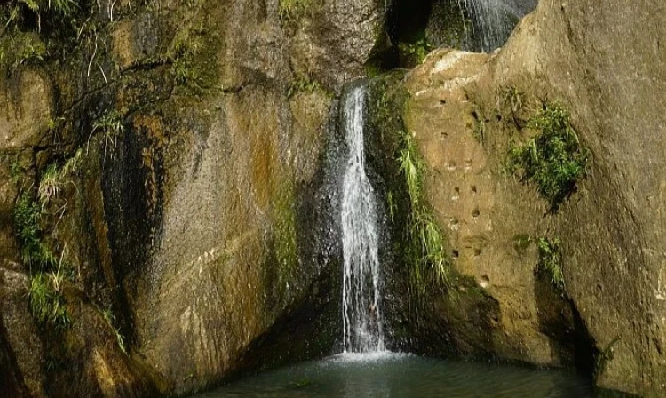
This track takes you inland from Orokawa Bay to the 28m William Wright Falls.
Distance
2.5 km
Walking time
1 hour
Difficulty
Advanced
Dogs
Not allowed
Wheelchair access
Not marked friendly
Current status
Weather outlook
Issued 10 Oct 2026, 4:55 pm
10 October 2026
Cloudy periods with the odd shower, mainly about the ranges. Northerlies.
11 October 2026
Showers, possibly heavy, clearing in the afternoon with increasing fine spells. Periods of rain developing west of Tauranga late evening. Northerlies, turning westerly in the afternoon.
12 October 2026
A few showers. Northwesterlies developing for a time in the afternoon.
13 October 2026
Partly cloudy, with isolated showers clearing in the evening. Northwesterlies developing in the morning.
14 October 2026
Mostly cloudy with a few showers developing in the morning. Northwesterlies developing in the morning.
Regional guidance only; elevation and terrain can produce different conditions.
Explore the area
Explore the track route and surrounding area before you set out.
To reach William Wright Falls, follow the Orokawa Scenic Coastal Track , then walk to the far end of Orokawa Bay and continue five minutes past the beach to the side track, or come from the Homunga Bay Track . The track was damaged by a landslide in 2013 and is now rated advanced, suitable for fit and experienced trampers. Expect long grass, stream crossings, and rough terrain. After about 30 minutes, watch for a side stream on the left—easily missed. Follow the orange markers for a final five-minute walk to the falls. Return via the same route. The full walk takes about 3.5 hours. Note: The waterfall may have little or no water during dry summers.
The track has multiple stream crossings and should not be attempted in heavy rain.
This track branches off the Orokawa Scenic Coastal Track , or the Houmanga Bay Track .
We encourage you to continue gaining the skills and knowledge required for a safe trip. The NZ Mountain Safety Council has lots of free resources and information you can use. These can be accessed via www.mountainsafety.org.nz . Level up in your outdoor knowledge with these interactive online learning tools: Trip Planning Tramping / field Skills Basic Navigation River Safety Additionally, check out the range of helpful videos available from the NZ Mountain Safety Council YouTube channel .
Track information, access and weather can change. Confirm current alerts and land-manager information close to departure, tell someone your plans, and carry equipment appropriate for the route and conditions.