11 October 2026
Showers, becoming few and far between in the afternoon, then clearing to fine in the evening.
Loading outdoor place details…
Hurunui District
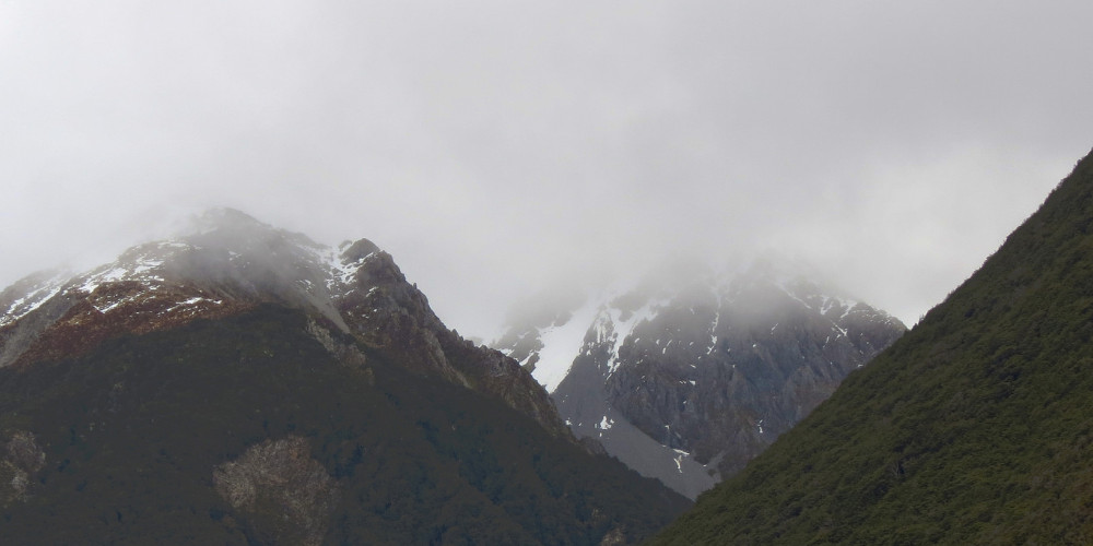
Te Araroa section: This tramp follows a historic crossing of the Southern Alps at Harper Pass (962m). Māori used the route to access pounamu (greenstone) on the West Coast, and European settlers used it for access and supply purposes during the gold rush of the 1860s. Harper Pass is named after Leonard Harper, who, at 20 years of age, became the first European to cross the pass and reach the West Coast in 1857.
Distance
112.8 km
Walking time
6-8 days
Difficulty
Advanced
Dogs
Not allowed
Wheelchair access
Not marked friendly
Current status
Weather outlook
Issued 10 Oct 2026, 9:23 pm
11 October 2026
Showers, becoming few and far between in the afternoon, then clearing to fine in the evening.
12 October 2026
Fine.
13 October 2026
A few showers developing.
14 October 2026
Rain, with heavy falls. Snow lowering to 2200 metres.
15 October 2026
A few showers, some possibly heavy, with snow to 700 metres.
Regional guidance only; elevation and terrain can produce different conditions.
Explore the area
Explore the track route and surrounding area before you set out.
The old Māori and settler route of the 19th century fell into disuse from 1867 following the development of an alternative route through Arthur’s Pass, which provided more direct access to the Coast. In the 1930s, the track was reopened and four substantial huts were constructed by the Physical Welfare Division of the Department of Internal Affairs in an attempt to recreate the Milford Track’s model for tourism success. While the Harper Pass Track has never reached the Milford Track’s status, it still affords a quality tramping experience of relative ease. Things to keep in mind On the West Coast side of Harper Pass, the route requires numerous crossings of the Taramakau and Otehake Rivers. Trampers with river-crossing skills and experience will find these rivers passable in normal to low flows but impassable when river levels are high. Extra food should be carried to enable trampers to backtrack or to wait until river levels subside. In a number of areas, this route requires a lot of self-navigation as it is not fully marked. Generally, this is straightforward though you’ll want to be carrying GPS, maps and a compass to assist you. The traditional Harper Pass Track starts at Windy Point and ends at Aitkens. St James Car Park (Boyle Village) to Hope-Kiwi Lodge - 27.5km / 8 hours Follow the Tūi Track sign and markers to the highway and then on the landward side of the fence on the left to a driveway leading to the old Boyle Base Hut. Cross the road here and follow the markers down to a terrace and then along to the Boyle River. If safe to cross, ford the Boyle River where markers indicate and continue down the true right bank on river flats to the confluence with the Doubtful River. If the river can not be crossed safely, back-track and continue down on the road shoulder for about 2 hours to the signpost marking the entrance road to the Lake Sumner Forest Park at Windy Point. You will pass the Engineers Camp along the way. There is a car park and shelter at Windy Point, a short distance down the entrance road. This marks the alternative and traditional starting point to the Harper Pass Track. After fording the Doubtful River where marked, the track continues down the true right of the Boyle River and joins a farm track that leads onwards to a deer fence. Follow this fence until markers show the track heading uphill through mānuka and beech forest towards the main Hope Valley track. Te Araroa joins the Harper Pass Track proper here. Turn right, and the track climbs through mānuka scrub and farmland to the beech forest’s edge. Once inside the forest, the track sidles above the Hope River to Hope Shelter, and a basic hut (6 bunks) can be found, which is old but still in reasonable condition. There is no water supply at the hut itself, so a walk down to the river could be required. DOC estimate 4 hours from Windy Point to Hope Halfway Hut (Hope Shelter) (8 km) Beyond Hope Shelter, the track continues through the forest and then breaks out across grassy flats. The track then crosses the Hope River on a swingbridge. Across the bridge, there is a junction with the track to St Jacob’s Hut. From here, Te Araroa heads south on the track to Hope-Kiwi Lodge, situated in a large clearing near the forest edge. DOC estimate 3 hours from Hope Halfway Hut to Hope Kiwi Lodge (7 km) Hope-Kiwi Lodge to Hurunui Hut — 18km / 6 hours Below Hope-Kiwi Lodge the track crosses open cattle flats and then climbs through the bush towards Kiwi Saddle (677m). A lookout nearby affords good views of Lake Sumner. Beyond the saddle, the track descends towards the lakeshore and to a swingbridge over Three Mile Stream. Cross the bridge, continue to the lake head and beyond up the Hurunui River’s true left side. Keep to the marked track until it deviates across the valley to another swingbridge, this time over the Hurunui River. Once on the other side of the river, the track climbs and sidles for about 30 minutes to Hurunui Hut, a modern hut with sleeping platforms and elevated views over the valley below. After crossing the Hurunui swingbridge southbound, dismount on the left side. There is a short steep climb to reach the path, which then sidles to the right above the bridge anchors. It may seem logical to turn right immediately at the end of the bridge, but this leads to a dead-end and forces a rough scramble up to rejoin the track. Hurunui Hut to Hurunui No.3 Hut - 10km / 4-5 hours The track descends from the hut through the mānuka forest to the open flats of the valley floor. About 2-thirds of the way, a sign indicates access to a hot pool (look for the steam rising from the stream just before that). Another sign at the pool warns; “Amoebic meningitis is fatal and caused by water entering nasal passages. Do not immerse head”. As long as you ensure your head stays above the water, feel free to swim in the pool, as it is a Te Araroa highlight. The sign indicating the hot spring may not be visible. Southbound walkers will encounter a small warm-water stream running down a rough rock face. The trail climbs the bank another 20 m past the warm steam, and the pool is accessed via a short side trail that may be marked with a small rock cairn. Beyond the hot spring, the track continues through flats and forest on the Hurunui’s true right all the way to Hurunui No.3 Hut. While one of the original 4 huts on the route, the No.3 Hut remains a comfortable (16 bunk) hut. It has an unusual-looking DOC research building nearby. Hurunui No.3 Hut to Locke Stream Hut — 15km / 7 hours Soon after leaving the No. 3 Hut, the track crosses Cameron Stream. An emergency 3-wire bridge can be used here to avoid getting wet feet. Continue across the flat towards Cameron Hut (4 bunks). This hut offers basic emergency accommodation for anyone in need. There is a fireplace, and the bunks were rebuilt in early 2021. Beyond Cameron Flat the track leaves cattle country and ascends towards Harper Pass Bivvy, a cramped 2 bunk box with one tiny window and a helpful sign on the door that reads ‘fire exit’. From the bivvy, the track crosses the Hurunui headwaters and climbs more steeply for 30 minutes to Harpers Pass. Kiwi are present in the area in reasonable numbers and can be heard at night. Watch out for their 3-pronged footprints as they are sometimes visible where the ground is soft. On the West Coast side of the Pass, the track drops steeply and crosses the Upper Taramakau River to the true right side. It continues down to a swingbridge, which takes trampers to the true left side. From here, it is about 1.5 hours downstream to Locke Stream Hut. Locke Stream Hut is another Physical Welfare Division classic. It was built in 1940 with hand-hewn timber by 65-year-old packman, Sam Burrows. The hut was restored in 1993 through a bequest from Tom Beeston’s estate. Locke Stream Hut to Morrison footbridge via Aitkens - 21.5km / 6-8 hours Beyond the hut, travel is down the Taramakau River through bush and open river terraces — though some pieces of track are affected by river damage. Travel is often in the riverbed and can require numerous river crossings that become impassable after heavy rain. Kiwi Hut (6 bunks) is located approximately halfway down the Taramakau (8km/3.5hr from Locke Stream Hut) and a 15-minute walk from the Kiwi Hut junction. Cross the Taramakau (to the true left) approximately 1km after the Kiwi Hut junction and then cross the Otehake River to continue on the true left of the Taramakau. When the rivers are running high, the Otehake may be the more dangerous of the two as it has a larger catchment. If the Taramakau River looks doubtful, it may be wiser to return to Kiwi Hut and wait for the rivers to drop. Previous advice to walk down the true right of the Taramakua from Kiwi Hut to cross just past Pfeifer Creek, following a 4WD route, has had to be changed as the river now cuts close to the right bank opposite the Otehake confluence, causing walkers to venture onto private property and pass private huts. Landowners have required DOC to modify the route After crossing the Otehake River the route is then mainly on the true left all the way down to the sign-posted turn-off onto the Flood Track to the Morrison Footbridge - though due to river movement at times, travel may be through the riverbed and require crossings. Trampers wishing to exit to the Aitkens carpark on SH73 should continue on the Aickens Track across the river flats and carefully ford the Otirā River at the marked point, aiming approximately towards the radio aerials on the far bank. Choose the crossing point with care, as the river may form deep pools. It may be shallower upstream from the radio aerials, which are near the exit track to SH73 From Aitkens, turn left for 22km to Arthur’s Pass, a small alpine village, or turn right for 73km to Greymouth on the West Coast. To rejoin the Te Araroa route after crossing the Otira river at Aickens turn left and walk 3.2 km along SH73 to Morrison Footbridge. Beware of fast traffic and rail crossings along the highway. There are paths beside the road for some parts. Meanwhile, Te Araroa continues left on the Flood Track for 2hr and joins with the Mingha-Deception Track at the Morrison Footbridge. The Flood Track is poorly formed, through the bush and involves a series of sharp climbs and descents along a steep face above the Otirā River - when the Otirā River is low, walkers may prefer to walk along the riverbed, though carefully judge the water level before attempting this. The flood track was cleared of obstacles in January 2021 but remains a difficult route, best avoided if the river is low enough for safe travel along the river bed. Cross the footbridge to access SH73. There is a carpark across the road. Mingha — Deception Track This route forms the mountain run component of the celebrated Coast-to-Coast race. Top athletes complete it in around 3 hours. On the Deception side, the track is rough and not regularly marked. However, in good conditions, it is a reasonable route which most trampers take 2 days to complete from Morrison Bridge to Bealey River. The route involves many river crossings, so is vulnerable to bad weather. Do not attempt it in heavy rain or when heavy rain is forecast. Come prepared to wait out flood conditions. The area is home to rare and protected blue duck/whio. DOC asks for sightings to be reported to staff at the Visitor Centre in Arthur’s Pass. SH73 (Morrison Bridge) to Goat Pass Hut — 14.5km / 8-9 hours Coming from SH73, cross the Otira River on the Morrison footbridge and follow the Deception River up the true right side across river flats. Cross to the true left and follow rock cairns through the lower gorge, re-crossing the river where necessary. Continue up to Good Luck Creek. Upper Deception Hut, which is easy to miss, is located a short distance beyond, on the true right side. Beyond the hut, trampers can pick their way upwards, mostly in the riverbed though there are some small tracked portions under bush cover. There is a final steep climb over rough terrain to get up to the Goat Pass Hut (20 bunks), located a short distance below the pass itself. This hut has a radio link to DOC’s visitor’s centre at Arthur’s Pass, which trampers can use to obtain weather forecasts and other information. The last 2 km from Upper deception Hut to Goat Pass Hut is arduous and may take 2 hours Northbound. Late in the afternoon it may be safer to stay the night at Upper Deception Hut Goat Pass Hut to SH73 Bealey River — 9.5km / 5 hours From the hut, the track improves significantly but still has many river crossings. The track crosses Goat Pass on boardwalk sections and then descends towards the bush line into the Mingha Valley. The track departs the river course towards Dudley’s Knob to avoid a difficult gorge and continues down to the Lower Mingha flats. Look for a safe crossing of the Bealey River near its confluence with the Mingha River and continue down towards Greyney Shelter (this is only a day shelter - no camping) on SH73. The track line rises to the road along the way. The closest campsite alternatives are Klondyke Corner on the banks of the Waimakariri and Avalanche Creek in Arthur’s Pass village, both $8/person/night.
Experience: Suitable for well-equipped people with previous backcountry tramping and river-crossing experience. Best season: Summer, autumn and winter Required maps: NZTopo50 Moana BU20 Haupiri BU21 Lake Sumner BU22 Boyle BU23 Hazards: Flooded rivers, steep drop-offs Safety: This route guide must be read in conjunction with Tramping in Arthur's Pass National Park (PDF, 762K) (opens in new window) , and New Zealand's Outdoor Safety Code (external site) . Before setting out, check the latest track conditions and avalanche advisory with the Before you go, tell someone your plans and leave a date to raise the alarm if you haven't returned. To do this, use the New Zealand Outdoors Intentions process (external site) on the AdventureSmart website. It is endorsed by New Zealand's search and rescue agencies and provides three simple options to tell someone you trust the details about your trip. Arthur's Pass (Carroll Hut) weather - NIWA Arthur's Pass (Carrington Hut) weather - NIWA Arthur's Pass (Avalanche Peak) weather - NIWA Arthur's Pass (Visitor Centre) weather - NIWA NIWA 3-day forecast Arthur's Pass
Getting there/away - To Christchurch and Greymouth East West Coaches - E: book@eastwestcoaches.co.nz - P: 027 201 8825 Greymouth Atomic Shuttles - P: 03 349 0697 East West Coaches - E: book@eastwestcoaches.co.nz - P: 027 201 8825
General information DOC's Arthurs Pass National Park Visitor Centre — SH73, Arthur's Pass — P: 03 318 9211 — E: arthurspassvc@doc.govt.nz Greymouth Greymouth i-SITE Visitor Centre — 1 Mackay St, Greymouth — P: 03 768 5101 — E: info@westcoasttravel.co.nz Before starting Te Araroa either as a through-walker of the whole country or a section walker, please register on Te Araroa website . Please also visit the website or download the app for detailed maps, trail alerts and other relevant information. This track is part of the Herenga ā Nuku Aotearoa track database. Herenga ā Nuku has maps and advice about public access to the outdoors . We encourage you to continue gaining the skills and knowledge required for a safe trip. The NZ Mountain Safety Council has lots of free resources and information you can use. These can be accessed via www.mountainsafety.org.nz . We recommend trying these online learning tools: Trip Planning Tramping/field Skills Basic Navigation River Safety Additionally, check out the range of helpful videos available from the NZ Mountain Safety Council YouTube channel .
Experience: Suitable for well-equipped people with previous backcountry tramping and river-crossing experience.Best season: Summer, autumn and winterRequired maps: NZTopo50 Moana BU20 Haupiri BU21 Lake Sumner BU22 Boyle BU23 Hazards: Flooded rivers, steep drop-offsSafety: This route guide must be read in conjunction with Tramping in Arthur's Pass National Park (PDF, 762K) (opens in new window), and New Zealand's Outdoor Safety Code (external site).Before setting out, check the latest track conditions and avalanche advisory with theBefore you go, tell someone your plans and leave a date to raise the alarm if you haven't returned. To do this, use the New Zealand Outdoors Intentions process (external site) on the AdventureSmart website. It is endorsed by New Zealand's search and rescue agencies and provides three simple options to tell someone you trust the details about your trip.
Track information, access and weather can change. Confirm current alerts and land-manager information close to departure, tell someone your plans, and carry equipment appropriate for the route and conditions.