9 October 2026
Cloudy, low with patchy drizzle in the east, but lifting for a time in the afternoon and evening.
Loading outdoor place details…
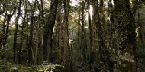
Tararua Forest Park
This track connects Atiwhakatu Valley with the alpine tops near Mt Holsworth. It is a more challenging track than the main track to Mt Holdsworth via Powell Hut.
Distance
3.6 km
Difficulty
Advanced
Dogs
Allowed — check local rules
Wheelchair access
Not marked friendly
Current status
Weather outlook
Issued 8 Oct 2026, 9:24 pm
9 October 2026
Cloudy, low with patchy drizzle in the east, but lifting for a time in the afternoon and evening.
10 October 2026
Cloudy with occasional showers, drizzly in the east in the morning.
11 October 2026
A few showers.
12 October 2026
Fine apart from isolated showers.
13 October 2026
Mostly cloudy with isolated showers.
Regional guidance only; elevation and terrain can produce different conditions.
Explore the area
Explore the track route and surrounding area before you set out.
East Holdsworth Track begins on Atiwhakatu Track . Just after the bridge over Holdsworth Creek, turn off Atiwhakatu Track and onto East Holdsworth Track. The track climbs steeply, all the way to the ridge between Mt Holdsworth and Mt Jumbo. Here it meets the Mt Holdsworth Jumbo Circuit . This track is a backcountry tramping track and is maintained to a lower standard than Atiwhakatu Track and the Mt Holdsworth Track. You can expect an unformed, rough track, where you have to clamber up and over tree roots. It is best suited to experienced trampers. Follow the orange markers to stay on the track.
East Holdsworth Track is very steep and physically demanding. You need good fitness for this track. Plan extra time in case it takes longer than you expect. Carry plenty of water and wear sturdy footwear with good grip. Walking poles may be helpful. Mt Holdsworth Track is an easier alternative. The Tararua Forest Park is well known for wild, fast-changing and unpredictable weather. Pack warm and waterproof clothing, even if the forecast is good. Carry emergency equipment including a torch, spare food, a distress beacon and an emergency shelter.
Jumbo Hut
This track connects with Atiwhakatu Track and the Mt Holdsworth Jumbo Circuit . Use this location in Google Maps to help find your way to the Mt Holdsworth carpark.
We encourage you to continue gaining the skills and knowledge required for a safe trip. The NZ Mountain Safety Council has lots of free resources and information you can use. These can be accessed via www.mountainsafety.org.nz . Level up in your outdoor knowledge with these interactive online learning tools: Trip Planning Tramping / field Skills Basic Navigation River Safety Additionally, check out the range of helpful videos available from the NZ Mountain Safety Council YouTube channel .
Dogs allowed. Keep dog under control at all times.
Track information, access and weather can change. Confirm current alerts and land-manager information close to departure, tell someone your plans, and carry equipment appropriate for the route and conditions.