10 October 2026
Cloud increasing, and showers developing this evening. Northeasterlies.
Loading outdoor place details…

Rangitoto Island
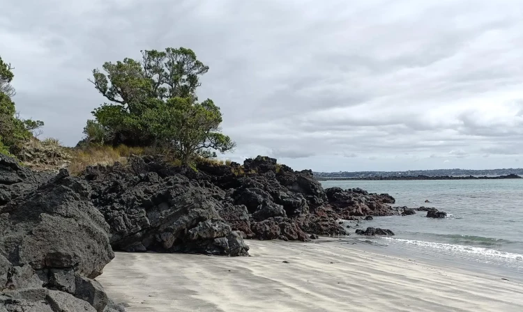
This coastal walk passes many remnants of human activity – boatsheds and baches near Rangitoto Wharf, old quarry sites, ruins of war time storage bases for mines, and Yankee Wharf which was built during World War II. Islington Bay is a popular for swimming, picnicking and as a yacht anchorage.
Distance
12.5 km
Walking time
4 hours
Difficulty
Easy
Dogs
Not allowed
Wheelchair access
Not marked friendly
Current status
No active alerts found. Conditions can still change, so check again before leaving.
Weather outlook
Issued 10 Oct 2026, 4:55 pm
10 October 2026
Cloud increasing, and showers developing this evening. Northeasterlies.
11 October 2026
Showers, possibly heavy, easing to the odd light shower by midday. Scattered rain developing late evening. Northwesterlies.
12 October 2026
Showers becoming isolated in the morning but remaining cloudy. Northwesterlies developing in the morning.
13 October 2026
Mostly cloudy with isolated showers developing in the morning. Northwesterlies.
14 October 2026
Partly cloudy with isolated showers. Northwesterlies.
Regional guidance only; elevation and terrain can produce different conditions.
Explore the area
Explore the track route and surrounding area before you set out.
This loop walk can be walked in either direction. These tracks are also used to access Motutapu Island. Coastal Track from Rangitoto Wharf to Islington Bay Wharf Time: 2 hr 30 min one way This coastal walk passes many remnants of human activity – boatsheds and baches near Rangitoto Wharf, old quarry sites, ruins of war time storage bases for mines, and Yankee Wharf built during World War II. Islington Bay is a popular for swimming, picnicking and as a yacht anchorage. Note: Sections of this track are over broken lava fields and the footing is rough and uneven. Good foot wear is essential. Inland route from Rangitoto Wharf to Islington Bay Wharf Time: 1 hr 30 min one way This alternative route to Islington Bay passes along a road built by prisoners. The road continues over the causeway to Motutapu Island.
Bring water with you. There are no supplies of drinking water on the island. Wear sturdy walking shoes that can cope with the rugged lava surfaces. Wear sunscreen and a hat. The heat reflecting off the ground can be intense. There are boardwalks on the summit track and the mangrove boardwalk near the Rangitoto Wharf. These are high in some places and you could fall up to 2m from them. Keep an eye on children.
All tracks begin at the Rangitoto Wharf, a 25-minute ferry ride from Queens Wharf and some sailings travelling via Devonport. You'll need at least half a day (4-5 hours) to visit Rangitoto Island. Please check the time of the last ferry at the start of your trip – a clock on the wharf will indicate the last departure each day.
We encourage you to continue gaining the skills and knowledge required for a safe trip. The NZ Mountain Safety Council has lots of free resources and information you can use. These can be accessed via www.mountainsafety.org.nz . We recommend trying these online learning tools: Trip Planning Tramping / field Skills Basic Navigation Additionally, check out the range of helpful videos available from the NZ Mountain Safety Council YouTube channel
Rangitoto is a scoria cone. It can get extremely hot on the Island during summer, as the scoria quickly heats up under sunny, light wind situations. Inland parts of Rangitoto (including the walk up to the summit) can experience summertime peak air temperatures that are estimated to be around 5 degrees warmer than mainland Auckland. During south-westerly wind flows in spring and summer, Rangitoto often experiences stronger winds for a time during the afternoon and evening period. While this reduces the risk of extremely hot temperatures on the Summit Walk, it can impact sea conditions for the ferry travelling to and from Rangitoto Island. If making your own way to the island, be aware of the marine conditions coming back to Auckland late in the day. Always check the MetService Waitemata Harbour forecast.
No dogs.
Track information, access and weather can change. Confirm current alerts and land-manager information close to departure, tell someone your plans, and carry equipment appropriate for the route and conditions.