09 October 2026
Partly cloudy, with the chance of a shower about the ranges. Light winds, but easterlies about Golden Bay.
Loading outdoor place details…
Nelson area
Takorika (721 m) is a hill immediately west of Havelock. A network of tracks provide several options for reaching the summit.
Distance
7.16 km
Walking time
20 min to 4 hours
Difficulty
Intermediate, Advanced
Dogs
On-lead only
Wheelchair access
Not marked friendly
Current status
No active alerts found. Conditions can still change, so check again before leaving.
Weather outlook
Issued 9 Oct 2026, 4:49 pm
09 October 2026
Partly cloudy, with the chance of a shower about the ranges. Light winds, but easterlies about Golden Bay.
10 October 2026
Cloud increasing with showers developing in the morning, then becoming rain overnight. Easterlies easing in the morning, then northerlies in the evening.
11 October 2026
Showers becoming isolated with longer fine breaks in the afternoon. Northeasterlies, turning westerly in the afternoon.
12 October 2026
Mainly fine, but isolated showers in the afternoon. Light winds.
13 October 2026
Partly cloudy. Light winds.
Regional guidance only; elevation and terrain can produce different conditions.
Explore the area
Explore the track route and surrounding area before you set out.
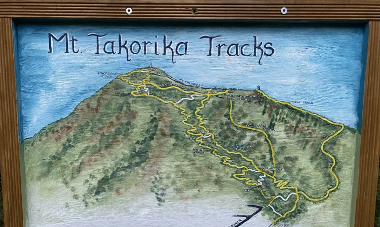
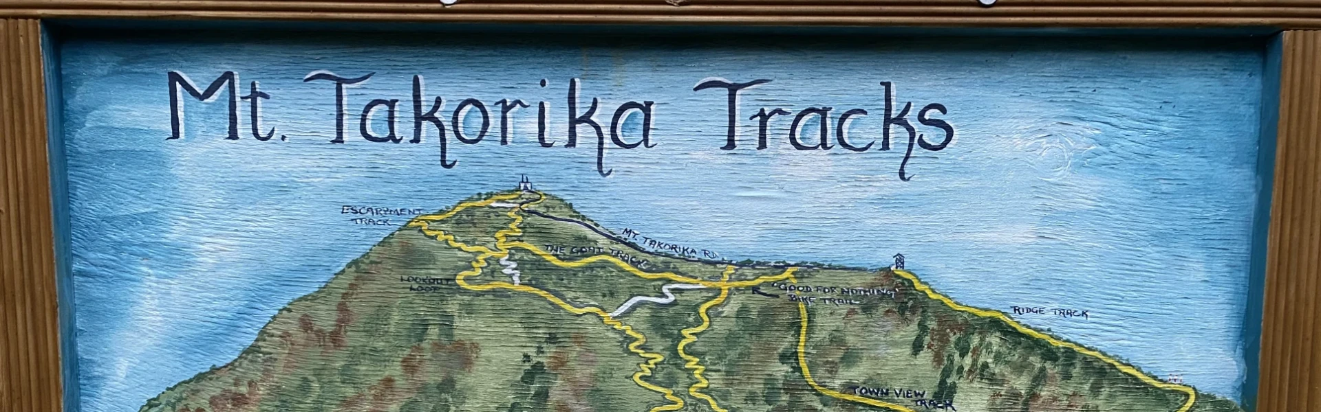
There are several routes to reach the summit of Takorika. Start by walking the 4WD road from the end of Lawrence Street to the junction where Main Track climbs left and Waterfall Track heads right. If you take Waterfall Track, the first waterfall appears shortly after the dam on an easy-grade section. A sign warns that the upper track is ‘unformed’—a rough scramble best suited for fit, confident walkers. If that’s not for you, return to the junction and take Main Track instead for a more gradual climb. Waterfall Track ascends a gully beside the stream that once supplied Havelock’s water. This gully contains the most pristine bush on Takorika’s Havelock side. It’s steep and a bit rugged, but scenic, with a second waterfall about 20 minutes further up. The track eventually meets Lower Track, where you turn left to reach Main Track. Due to its steepness, Waterfall Track is recommended only as an uphill route. Lower Track contours eastward and joins Main Track, which climbs a little further to the Lookout Track junction. Branching left, Lookout Track leads to boulders with excellent views over Havelock—rivaling those at the summit. Further on, it connects with Escarpment Track, which climbs alongside a rocky escarpment, offering views south down the valley. The track then enters beech forest and skirts Mt Richmond Forest Park before reaching the summit. At the top, a trig point and wooden platform provide great views of Havelock, Pelorus Sound, and the surrounding forest. For the return, the simplest option is descending via Main Track, which zig-zags through regenerating native bush all the way to the bottom.
The tracks are not located within DOC conservation land and are primarily maintained by local volunteers Camilla and John. They have made neat hand-painted signs that provide clear directions along all tracks on the hill. They also maintain a trapping network that is helping to increase native bird numbers. Dogs are permitted on leash. If you take a dog, you need to have it well under control, as there are slippery sections of track where a dog straining on its leash could cause its owner to slip.
Havelock is an hour-long drive along State Highway 6 from Nelson, via Whangamoa and Rai saddles. From Blenheim it is a 30 min drive, also along State Highway 6. Takorika Track is accessed from Lawrence St, which is a side-street off of SH6 in Havelock. Where Lawrence St turns south to become Takorika St, there is a small grassed parking area on the right with a hand-painted map showing the various tracks. Use this location in Google Maps to find your way there.
We encourage you to continue gaining the skills and knowledge required for a safe trip. The NZ Mountain Safety Council has lots of free resources and information you can use. These can be accessed via www.mountainsafety.org.nz . We recommend trying these online learning tools: Trip Planning Tramping / field Skills Basic Navigation River Safety Additionally, check out the range of helpful videos available from the NZ Mountain Safety Council YouTube channel
On leash.
Track information, access and weather can change. Confirm current alerts and land-manager information close to departure, tell someone your plans, and carry equipment appropriate for the route and conditions.