11 October 2026
Showers, possibly heavy in the morning, clearing in the afternoon with increasing fine spells. Periods of rain developing late evening. Northerlies, turning westerly in the morning.
Loading outdoor place details…
Ruapehu
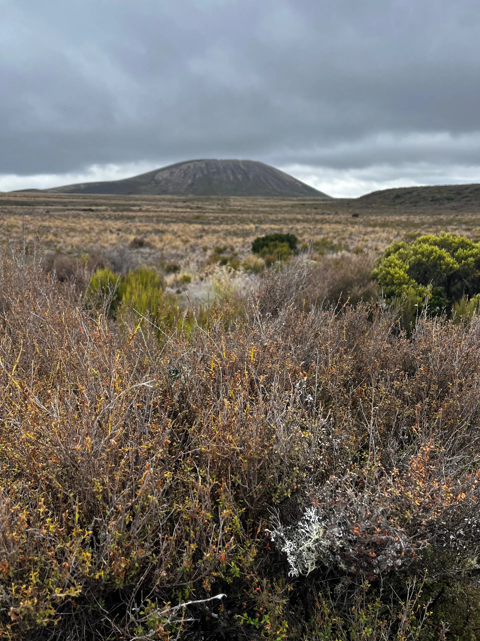
Te Araroa section: Tramp through the tussocks and shrublands to National Park, gateway to active volcanic mountains that dominate the iconic and majestic landscape as you walk. The notes for this section are frequently edited to adapt to track changes caused by the November and December Tongariro fires. Directions that are temporarily incomplete are marked with a line-through.
Distance
30 km
Walking time
1 -2 days
Difficulty
Intermediate
Dogs
Not allowed
Wheelchair access
Not marked friendly
Current status
Following the scrub fire in Tongariro National Park in November 2025, The Mangetepopo Track is closed indefinitely. This track was previously used by Te Araroa walkers to get between the the Tongariro Alpine Crossing and Whakapapa Village. While the Tongariro Alpine Crossing remains open to walk, the Mangatepopo Road is only open to approved tour and shuttle operators for the time being. The road is narrow and dusty and DOC have asked that if walkers choose to walk the Alpine Crossing, they use an approved shuttle operator to get out to National Park, rather than walk down the Mangetepopo Rd. For walking alternatives with equally amazing views of the park, check the Notices for Northern Circuit Detour and Round the Mountain Detour.
Weather outlook
Issued 10 Oct 2026, 11:01 pm
11 October 2026
Showers, possibly heavy in the morning, clearing in the afternoon with increasing fine spells. Periods of rain developing late evening. Northerlies, turning westerly in the morning.
12 October 2026
Occasional rain. Light winds, then northwesterlies developing in the afternoon.
13 October 2026
Occasional rain. Northwesterlies developing in the morning.
14 October 2026
A few showers. Northwesterlies developing in the morning.
15 October 2026
Showers, some possibly heavy. Northerlies.
Regional guidance only; elevation and terrain can produce different conditions.
Explore the area
Explore the track route and surrounding area before you set out.
Mangatepopo Track — 9km / 3-4 hours - CLOSED The Mangatepopo Track between Mangatepopo Hut (km 1,143.5) and Whakapapa Village (km 1,172.48) is closed. DOC have advised that Mangatepopo Road is used mostly by shuttles and buses and is narrow, windy and dusty, making it unsafe for walkers. They would much prefer hikers take a shuttle or a different route. Round the Mountain detour Hikers can bypass Mangatepopo Hut and the closed track by following the new Te Araora route that uses rhe Northern Circuit route clockwise from the Emerald Lakes (km 1,144) past Oturere Campsite, Waihohohu Hut and the Tama Lakes to rejoin the Te Araroa route at Whakapapa Village. Continue from there on the Whakapapaiti Valley Track and Mangahuia Track to reach SH 47 at the Mangahuia Campsite and follow SH 47 for 6.4 km to National Park/Waimarino (km 1,172) The distance from the Emerald Lakes junction to Whakapapa Village is approximately 28 km . Oturere Hut and Campsite are closed for renovation. Waihohonu Campsite is open. Waihohonu Hut is bookable with 20% discount for Te Araroa Trail Pass Holders. Following the Tongariro Northern Circuit track from near the highpoint on the Tongariro Alpine Trail at Emerald Lakes (km 1,144) and past Waihohohu Hut there is an optional longer detour available, using the Round the Mountain Track. The Round the Mountain starts from Waihohonu Hut heading south and traverses diverse volcanic, desert and forest landscapes, passing Rangipo Hut, Mangaehuehu Hut, Ohakune Mountain Road, Mangaturuturu Hut and Whakapapaiti Hut to rejoin Te Araroa Trail at km 1,178.4, the start of the Mangahuia Track out to SH 47. It crosses two dramatic swingbridges and takes 2 - 4 days The distance form Waihohonu Hut to to rejoin Te Araroa at km 1,178.4 is approximately 48 km Whakapapaiti Mangahuia Track - 13.5km / 5-6 hours The track traverses forest, wetlands and open tussock lands. It can be boggy in the wet. The track may be rutted. Leave the Whakapapa Village on Whakapapaiti Track. It starts opposite the Fire Station, just above the Holiday Park and 250m from the Whakapapa Visitor Centre Initially, the track flows easily and descends through groves of kaikawaka and cabbage trees amongst the beech forest. The track then descends through an open area to a bridged river crossing over the Whakapapaiti Stream before coming across a track intersection. The Whakapapiti Hut is approximately 3 km up the track to the left. It is not part of Te Araroa,but is included in the Trail Pass. Before reaching the hut the track crosses the Whakapapiti Stream. The crossing over boulders is normally easy but may be difficult after heavy rain Turn right (northwest) onto the Mangahuia Track and head to the Mangahuia campsite (2-3 hours). There are a few stream crossings on this track, easy to cross in dry weather but can be difficult when the streams are high - take care and be prepared to wait for levels to drop. Mangahuia Campsite to National Park - 6.5km From the Mangahuia campsite, walk 500m north on the vehicle track to join SH47. Turn left (west) and follow the road for 6km to the junction with SH4. Turn right (north) into the National Park Village, then turn left (west) onto Findlay Street. It flows into Station Road. At the very end is National Park Railway Station.
Potential Hazards Vehicles on road or track Poisons & traps River crossings - Never cross flooded rivers Small stream crossings Track exposed to sun, wind or cold Weather extremes Few water sources - avoid drinking from streams with high mineral content. Tongariro (Upper Tama Lake) weather - NIWA Tongariro (Visitor Centre) weather - NIWA Mt Ruapehu (Knoll Ridge Café) weather - NIWA Mt Ruapehu (Turoa Giant Café) weather - NIWA Mt Ruapehu (Turoa -Waitonga Falls) weather - NIWA
Northern Start: Mangatepopo Track turnoff, Tongariro National Park Southern End: Railway Station, Station Road, National Park Getting there/away InterCity - P: 09 583 5780 Transport to trailheads Daily to Tongariro Alpine Crossing and 42 Traverse Mountain Howards Lodge BBH - 43 Carroll St - P: 07 892 2827 - E: info@howardslodge.co.nz Plateau Lodge - 17 Carroll St - P: 0800 861 861 freephone - E: info@plateaulodge.co.nz Tongariro Crossing Shuttles - P: 07 892 2993 E: info@tongarirocrossingshuttles.co.nz
NiwaWeather - Tongariro Visitor Centre DOC - Book Department of Conservation huts or purchase camping tickets online or at a Department of Conservation office DOC Whakapapa Visitor Centre - State Highway 48, Whakapapa Village - P: 07 892 3729 - E: tongarirovc@doc.govt.nz Ōhakune Visitor Centre Ruapehu i-Site - 54 Clyde Street, Ōhakune P: 0800 647 483 Before starting Te Araroa either as a through-walker of the whole country or a section walker, please register on Te Araroa website . Please also visit the website or download the app for detailed maps, trail alerts and other relevant information. This track is part of the Herenga ā Nuku Aotearoa track database. Herenga ā Nuku has maps and advice about public access to the outdoors . We encourage you to continue gaining the skills and knowledge required for a safe trip. The NZ Mountain Safety Council has lots of free resources and information you can use. These can be accessed via www.mountainsafety.org.nz . We recommend trying these online learning tools: Trip Planning Tramping/field Skills Basic Navigation River Safety Additionally, check out the range of helpful videos available from the NZ Mountain Safety Council YouTube channel .
Potential HazardsVehicles on road or track Poisons & traps River crossings - Never cross flooded rivers Small stream crossings Track exposed to sun, wind or cold Weather extremes Few water sources - avoid drinking from streams with high mineral content.
Track information, access and weather can change. Confirm current alerts and land-manager information close to departure, tell someone your plans, and carry equipment appropriate for the route and conditions.