9 October 2026
Cloud about the tops.
Loading outdoor place details…
Murchison area
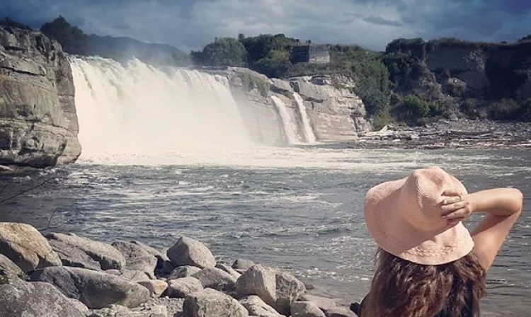
Walk to a waterfall created following the 1929 Murchison earthquake. It's not safe to swim here.
Distance
0.25 km
Walking time
10 min return
Difficulty
Easiest
Dogs
Not allowed
Wheelchair access
Not marked friendly
Current status
No active alerts found. Conditions can still change, so check again before leaving.
Weather outlook
Issued 9 Oct 2026, 7:33 am
9 October 2026
Cloud about the tops.
10 October 2026
Cloud increasing with showers developing in the morning, becoming rain at night with snow to 2000 metres.
11 October 2026
Rain, clearing in the evening. Snow to 2000 metres until afternoon.
12 October 2026
Partly cloudy.
13 October 2026
Cloud increasing.
Regional guidance only; elevation and terrain can produce different conditions.
Explore the area
Explore the track route and surrounding area before you set out.
Track Description Before 1929, the river here was flat. Then a huge earthquake uplifted the riverbed and created the Maruia Falls. They’re spectacular after a high rainfall. The walk itself is very short and well-maintained. It’s easily accessible but is quite steep. Most people should be able to navigate the walk-through regenerating forest to the river’s edge. It’s a great opportunity to stretch the legs on a long road trip and most would say it’s worth stopping for. Please enjoy the falls from behind the safety barriers. It’s not safe to swim here. There are whirlpools beneath the surface and several people have died. We suggest you either wear long layers or apply insect repellent before going on the walk. Sandflies and wasps can be bothersome here. There are toilets located at the carpark, and picnic tables are found down near the river. Food and petrol services are located in nearby Murchison. Getting There The falls are located near Shenandoah, on State Highway 65 between Springs Junction and Murchison. It’s a 15-minute drive from Murchison where there are several amenities. There is plenty of parking in the carpark. Use this location in Google Maps to find your way there. Helpful resources Find tips, guides and how-to videos to help you prepare for your walk at mountainsafety.org.nz
No dogs.
Track information, access and weather can change. Confirm current alerts and land-manager information close to departure, tell someone your plans, and carry equipment appropriate for the route and conditions.