10 October 2026
Cloudy. A few showers developing this afternoon, possibly heavy and thundery with hail.
Loading outdoor place details…
Nelson Lakes National Park
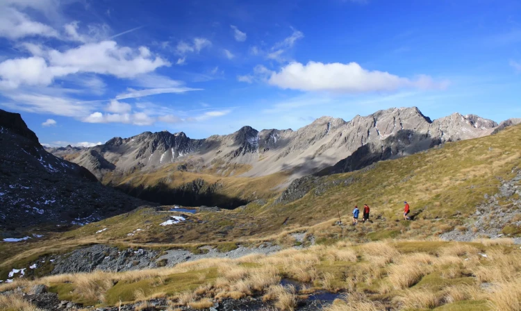
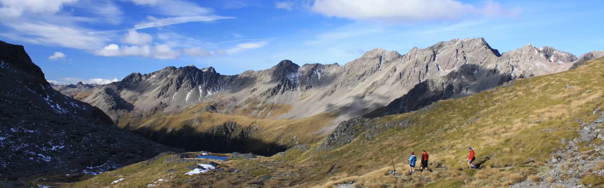
Experience tranquil beech forests, fields of waving tussocks, 2000‑m‑high mountains, and clear rushing streams in the heart of the mountains of Nelson Lakes National Park. This track is part of Te Araroa Trail.
Distance
88.7 km
Walking time
4 - 7 days
Difficulty
Advanced
Dogs
Not allowed
Wheelchair access
Not marked friendly
Current status
Weather outlook
Issued 10 Oct 2026, 7:33 am
10 October 2026
Cloudy. A few showers developing this afternoon, possibly heavy and thundery with hail.
11 October 2026
Rain, easing early afternoon, clearing late afternoon. Snow to 2000 metres until afternoon.
12 October 2026
Fine, but becoming overcast in the evening.
13 October 2026
A few showers.
14 October 2026
Heavy rain easing.
Regional guidance only; elevation and terrain can produce different conditions.
Explore the area
Explore the track route and surrounding area before you set out.
The circuit can be started from either St Arnaud or Mt Robert carpark. Most trampers start and finish at St Arnaud, as leaving a vehicle there is safer, however if you can arrange for someone to drop you off or pick you up at Mt Robert, this saves a few kilometres of walking around West Bay. Additionally, some trampers take a water taxi to the head of Lake Rotoiti to start their trip. From Kerr Bay : Beginning at the eastern end of the bay, the Lakehead Track wanders through forest, crossing several shallow streams and shingle screes. Small beaches along the way offer picnicking opportunities and mountain views. At the head of Lake Rotoiti, the grassy flats of the lower Travers Valley greet you. Lakehead Hut is 15 min on from the jetty. From West Bay : Walk up Mount Robert Road to where the Lakeside Track descends to the lake edge through dense mānuka and kānuka forest. Follow the lake shore to Coldwater Hut, which is perched right on the water’s edge. The short diversion to Whisky Falls is worthwhile.
From Lakehead or Coldwater huts, walk up the Travers River flats through forest and clearings (remnants from the valley’s farming days). The track from Coldwater Hut passes the turn‑off to Rotomaninitua/Lake Angelus. After 1 hr 30 min of easy walking you’ll reach a swing bridge, beyond which the track continues on the west bank of the Travers River. Soon the valley narrows and walking becomes more varied, alternating between forested terraces and grassy river flats. Mount Travers can be glimpsed as the track nears Hopeless Creek. Cross the creek on a swing bridge. Soon you’ll leave the river and notice the gradient becoming steeper. As it eases, you’ll hear the river again, cross a few small creeks and suddenly emerge to the welcome sight of John Tait Hut at the head of a small clearing.
Continue beyond John Tait Hut to Cupola Creek chasm, from where the track climbs steeply, leaving the river in its gorge below. A sign marks a short side‑track to Travers Falls, a 20‑m cascade plunging into a deep bowl. Back on the main track, the gradient soon eases. Cross several screes, and eventually the Travers River via a short bridge. From here, the forest is noticeably stunted and the track, although steep again, offers occasional views of the looming mountains. Finally, the track levels and emerges from the trees onto an extensive tussock‑covered flat, where Upper Travers Hut nestles at the base of the east face of Mount Travers.
Poukirikiri/Travers Saddle is an alpine pass requiring ice axes and crampons in winter and well into spring. Watch the video above to see a more detailed description of this section. Be prepared for sudden weather changes. The Sabine side of the saddle in particular is exposed to avalanches. At Upper Travers Hut, the track becomes a route marked with snow poles as far as the bushline on the Sabine side. Cross the Travers River near the hut and follow the poles through dense alpine shrubs. Leaving the boulder‑strewn valley, the track steepens and zigzags up a scree slope before continuing more gently to the saddle with its panoramic views. The saddle is 450 m above the hut, about 1 hr 30 min walking. From the saddle, the descent is steep – the Sabine forks lie 1000 m below. The track crosses tussock and scree, then briefly enters stunted beech forest before emerging into a steep gully. Descend by zigzagging to the valley floor, where the track begins again and the walking becomes easier. Ten minutes further on, a bridge crosses the deep chasm of the East Branch Sabine River. The track sidles around the edge of this chasm before descending into the West Branch Sabine River valley and heading upstream a short distance to West Sabine Hut. Side Trip to Rotomairewhenua/Blue Lake (7 hours return) This is a worthwhile side‑trip from the main circuit. Head upstream from the West Branch Sabine swing bridge. After 1 hr 30 min, the valley broadens and the track passes through forest destroyed by an avalanche in 1980. Climb steeply in two stages to a high basin containing Blue Lake Hut. Rotomairewhenua/Blue Lake is thought to be the clearest natural freshwater lake in the world. Please respect this pristine water by refraining from washing or swimming in the lake.
Use the swing bridge upstream of the hut to cross the West Branch Sabine River. The track down the valley sidles above the river and crosses three long, open flats. Leave the river where it enters a gorge in the lower valley. Climb steeply, then descend again, rejoining the deep river at a bridge across a narrow cleft. Easy walking leads to Sabine Hut, with its expansive views over Lake Rotoroa. From Sabine Hut there are two ways to finish the tramp: either by tramping via Speargrass Hut and the Speargrass Valley or taking the Rotoroa Water Taxi to Rotoroa village.
Follow the track along the lake front before climbing up to Howard Saddle. You'll then begin a long sidle in and out of several small valleys and through delicate wetlands. After about 5 hours, the track reaches a saddle, from where it descends to a clearing above Speargrass Hut. Leaving Speargrass Hut, cross the bridge over Te Horowai/Speargrass Creek and enter the forest. A well‑graded track descends to the valley floor and follows the river before climbing gradually for some distance to Mount Robert car park, overlooking Lake Rotoiti. This takes around 1.5 hours. If you are not being picked up here, it is another 1.5 hours down Mount Robert Road and around West Bay to St Arnaud village. Alternative return including Rotomaninitua/Lake Angelus via Mount Cedric This is a very exposed route to the Angelus basin and takes around 6 hours, so an overnight stay at Angleus Hut is strongly encouraged for anyone tramping this route. The track begins behind Sabine Hut and climbs very steeply and steadily to the bushline. Poles and cairns mark the route from here, which eventually drops off the eastern side of a high ridge and descends to Rotomaninitua/Lake Angelus. Angelus Hut requires bookings all year round. From here, depending on weather conditions, either continue to Mt Robert carpark via Robert Ridge , descend to Speargrass Hut and the Speargrass track (as described above). A challenging option is to take Cascade Creek route down to Lakehead Hut, but this is very steep in places.
Be prepared with plenty of food and warm and waterproof clothing as freezing conditions and/or heavy rain can occur at any time of year. You need to be prepared to spend an extra night. If you doubt your abilities or the weather, particularly near Poukirikiri/Travers Saddle or at unbridged stream crossings after heavy rain, turn back. It is strongly recommended that you take a personal locator beacon or satellite messenger device with you. With snow on the ground, Poukirikiri/Travers Saddle and side trips into the alpine basins should only be attempted by experienced and well‑equipped groups. Be wary of avalanches. Avalanches occur in the park every year, normally between June and October but sometimes as late as December. Most occur during winter storms or in spring/ early summer when warmer temperatures or rain make the snow unstable. The Travers – Sabine Circuit has more than 20 recognised avalanche paths. There are high numbers of wasps, particularly between January and April. Consider carrying an antihistamine product and, if you are allergic to their stings, ensure you carry medication with you. You’ll also want to bring insect repellent as the sandflies can detract from your experience at the lakes.
A Backcountry Hut Pass or Backcountry Hut Tickets are required to stay in all of the huts on the circuit. For those intending to deviate from the common circuit and include a stay at Angelus Hut , be aware that bookings are required year round.
We encourage you to continue gaining the skills and knowledge required for a safe trip. The NZ Mountain Safety Council has lots of free resources and information you can use. These can be accessed via www.mountainsafety.org.nz . We recommend trying these online learning tools: Trip Planning Tramping / field Skills Basic Navigation River Safety Additionally, check out the range of helpful videos available from the NZ Mountain Safety Council YouTube channel .
Freezing conditions and/or heavy rain can occur at any time of year. If you doubt your abilities or the weather, particularly near Travers Saddle or at unbridged stream crossings after heavy rain, turn back.
No dogs.
Track information, access and weather can change. Confirm current alerts and land-manager information close to departure, tell someone your plans, and carry equipment appropriate for the route and conditions.