11 October 2026
Showers about the Divide, clearing in the evening, otherwise fine.
Loading outdoor place details…
Hurunui District
Te Araroa section: This long tramp connects the Travers-Sabine Circuit with the St James Walkway. It's an extraordinary summer tramping experience at the Southern Alps' northern end. St Arnaud is a pleasant tourist village on the shore of Lake Rotoiti. Nelson Lakes National Park is serviced by a network of spacious, popular huts.
Distance
115.5 km
Walking time
5-8 days
Difficulty
Advanced
Dogs
Not allowed
Wheelchair access
Not marked friendly
Current status
Weather outlook
Issued 11 Oct 2026, 7:33 am
11 October 2026
Showers about the Divide, clearing in the evening, otherwise fine.
12 October 2026
Fine.
13 October 2026
Isolated showers, becoming widespread in the evening.
14 October 2026
Heavy rain easing.
15 October 2026
A period of rain with snow to 700 metres, otherwise isolated showers.
Regional guidance only; elevation and terrain can produce different conditions.
Explore the area
Explore the track route and surrounding area before you set out.
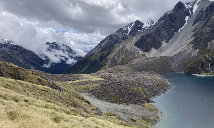
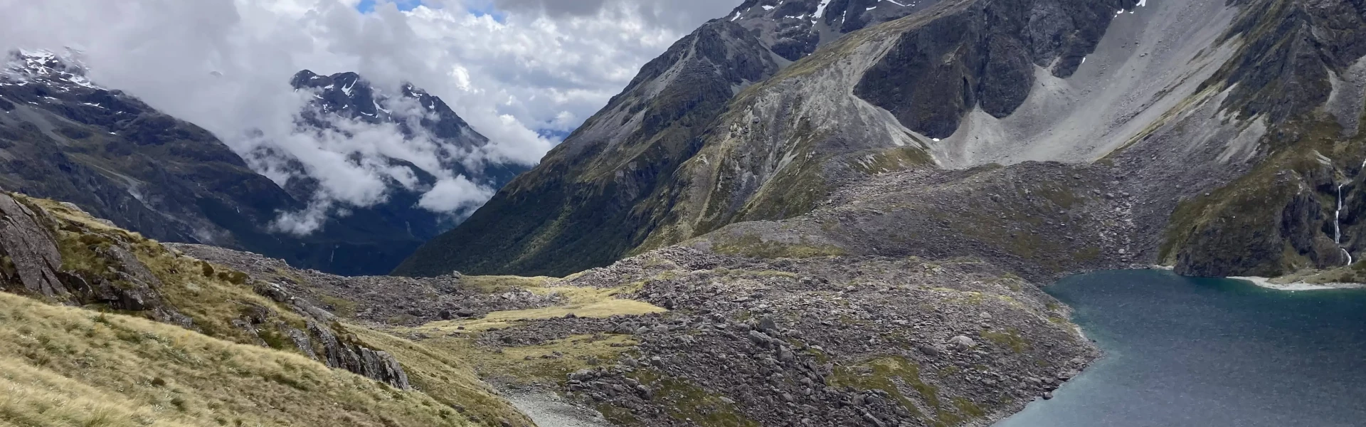
St Arnaud to Lakehead Hut - 9.5km / 2-3 hours The track starts opposite St Arnaud's alpine store. This is on the Black Valley Walk, which heads through beech forest to DOC's Kerr Bay Campground on the shore of Lake Rotoiti. Te Araroa then joins with the Travers/Sabine Circuit at the eastern end of Kerr Bay. From here the track follows the shoreline through the Rotoiti Nature Recovery Project area to Lakehead Hut. This is about 15min beyond the jetty near the lakehead. The recovery project started in 1997 and is one of 6 maintained by DOC. Its goal is to restore native biodiversity to the beech forest. A trapping and poisoning programme aims to rid a 5,000ha block of introduced pests including cats, possums, stoats, wasps, rats and mice. Kaka and reintroduced great spotted kiwi are two native species that benefit from the project. Booking is required for Lakehead Hut. Hut tickets are no longer accepted, and it is NOT covered by the Backcountry Hut Pass from 1 Oct to 30 April each year. However, Te Araroa Trail Pass, Backcountry Hut Pass, or 1 standard hut ticket can still be used for camping outside of the hut at any time. See the Trail Pass accommodation section below for more information on discount and booking. Lakehead Hut to John Tait Hut - 14.5km / 5 hours The well-graded track continues from Lakehead Hut up the river flats through open and forested sections to John Tait Hut. Mt Travers comes into view around Hopeless Creek. John Tait (1901-1982), a former president of the Nelson Tramping Club, led a volunteer effort to raise funds and to construct the original hut in 1951. This was 5 years before Nelson Lakes National Park became New Zealand’s 8th national park. The original hut survived 27 years. A new hut sits in a clearing with views of Mt Travers and Mt Cupola. Booking is required for John Tait Hut. Hut tickets are no longer accepted, and it is NOT covered by the Backcountry Hut Pass from 1 Oct to 30 April each year. However, Te Araroa Trail Pass, Backcountry Hut Pass, or standard hut tickets can still be used for camping outside of the hut at any time. See the Trail Pass accommodation section below for more information on discount and booking. John Tait Hut to Upper Travers Hut - 6.5km / 3 hours Beyond John Tait Hut the track continues up the Travers Valley and has some steeper sections. The track passes marked turn-offs to Cupola Hut and Travers Falls, which is a short and worthwhile side trip. Upper Travers Hut sits on the edge of a large flat immediately below Mt Travers. Booking is required for Upper Travers Hut. Hut tickets are no longer accepted, and it is NOT covered by the Backcountry Hut Pass from 1 Oct to 30 April each year. However, Te Araroa Trail Pass, Backcountry Hut Pass, or 1 standard hut ticket can still be used for camping outside of the hut at any time. See the Trail Pass accommodation section below for more information on discount and booking. Upper Travers Hut to West Sabine Hut - 8.2km / 6-8 hours The track continues as a defined ground trail that follows snow poles up to Travers Saddle (1787m). This is a steady 450m climb. From the Saddle, the snow poles continue down the western face to the tree line. The track then takes walkers down to the East Branch Sabine River in the valley floor below. This is a long and in places steep descent and crosses a large avalanche risk zone. Take the alternative marked track during times of avalanche risk. From the East Branch Sabine River, the track climbs, sidles and then descends to the West Branch Sabine River. West Sabine Hut is a short distance upstream. Booking is required for West Sabine Hut. Hut tickets are no longer accepted, and it is NOT covered by the Backcountry Hut Pass from 1 Oct to 30 April each year. However, Te Araroa Trail Pass, Backcountry Hut Pass, or 1 standard hut ticket can still be used for camping outside of the hut at any time. See the Trail Pass accommodation section below for more information on discount and booking. Change to Travers Saddle Track Note for NZTopo50 map users. The Te Araroa map for this section is based on LINZ Topo50 map (BS24 Mount Robert 2018). The black dashed line does not correctly show a later modification to the route. The yellow Te Araroa route is correctly marked on Map 99. At km 2026.5 southbound follow the poled route down the ridge. The older route, still shown on the maps, is visible leading to the right, but was abandoned due to track damage in the steep valley. For northbound travel follow the poled route up the ridge after km 2028. West Sabine Hut to Blue Lake Hut - 7.3km / 3 hours Te Araroa leaves the Travers/Sabine Circuit from West Sabine Hut and continues up towards Blue Lake and Waiau Pass. Trampers wishing to return to St Arnaud can continue on the circuit. From the hut follow the Blue Lake Track up the West Branch Sabine River to its source. The route is forested and climbs steeply in places, in particular during the short final climb to the hut and lake. The track crosses several short avalanche risk zones. Blue Lake Hut is a popular side trip to the Travers/Sabine Circuit. Booking is required for Blue Lake Hut. Hut tickets are no longer accepted, and it is NOT covered by the Backcountry Hut Pass from 1 Oct to 30 April each year. However, Te Araroa Trail Pass, Backcountry Hut Pass, or 1 standard hut ticket can still be used for camping outside of the hut at any time. See the Trail Pass accommodation section below for more information on discount and booking. Conservation – Your help is needed please. Help stop the spread of lindavia (lake snow algae) to Blue Lake and Lake Constance Lindavia is an invasive microscopic algae that causes a sticky mucus known as lake snow. It is already present in Lakes Rotoiti and Rotoroa. Trail walkers are asked to help stop it spreading to the area’s pristine alpine waters. Please use a cleaning station at Coldwater Hut, Lakehead Hut, or Sabine Hut for all gear that's wet from river, stream, or lake water. Important : Do not swim, wash, take water from or put any equipment into Rotomairewhenua / Blue Lake or Rotopōhueroa / Lake Constance. Your damp swimsuit or water filter may contaminate these pristine lakes. These lakes also hold high cultural significance to Māori, particularly Ngāti Apa ki te Rā Tō iwi. They are tapu (sacred) and access restrictions have been placed to uphold their mauri (life force) and purity. Show respect by not touching the water. Not touching the water in these lakes will also prevent the introduction of lindavia. You can swim and fill drink bottles in the Sabine River below the outlet of Blue Lake. Before swimming or taking water from any other alpine lake or tarn, including Lake Angelus, ensure all your gear has been completely dry for 48 hours. Be extra careful if you’ve recently swum or filled a drink bottle from Lakes Rotoiti or Rotoroa Thank you for helping take care of these beautiful places! See more about lindavia www.doc.govt.nz/lindavia Blue Lake Hut to Upper Waiau Forks - 7.8km / 6-8 hours The next section, over Waiau Pass, is the most demanding on this track. It is a fair-weather route, suitable for experienced individuals or parties with experienced leadership. Good fitness and reasonable agility is a prerequisite for all. Waiau Pass is a Te Araroa highlight. Allow a full day for the journey. The track leaves Blue Lake Hut through the forest and climbs onto Lake Constance's moraine dam. The lake itself is attractive and set within a dramatic alpine landscape. From the dam, a rough and rocky track, marked by snow poles, leads up above bluffs on the west side of the lake. Then it descends very steeply in places to the lakehead. The track continues across the open upper valley floor and then climbs a steep scree slope in direct fashion to a high terrace. From here it is a 500m sidle and climb up to Waiau Pass. The route from the pass continues through the rocky and exposed country. Take care when turning off the main ridge to follow the poled track route as it then drops steeply in places through bluffs to a terrace. Continues west before descending to the West Branch Waiau River in the valley floor. This area is an avalanche hazard zone in Spring and early Summer. From the valley floor, the track follows the river through thick sub-alpine scrub to the Upper Waiau Forks. There is an attractive informal campsite here within a stand of beech trees. Upper Waiau Forks to Waiau Hut - 8.9km / 4-5hr The track follows the Waiau River down and stays mostly on the true right. The valley opens up as you near Waiau Hut (6 bunks), new in 2017 thanks to a generous donor. Caroline Creek Bivouac, which is marked on NZ Topo50 maps near km 2052, was removed by DOC in March 2022. Waiau Hut to Anne Hut - 26km / 7-8 hours Travel down the valley is easy, through grassy flats, and on the Waiau River’s true right. Two bush-clad terminal moraines add interest and provide good camping opportunities. In time the Ada homestead comes into view. The homestead area remains in private hands. Trampers should avoid this area and continue to the Ada River. This is a straightforward crossing in low to normal flows. Beyond the river, trampers link to the St James Walkway and continue down in a south-west direction towards Anne Hut – a nice 20 bunk hut. Booking is required for Anne Hut. Hut tickets are no longer accepted. Te Araroa Trail Pass, Backcountry Hut Pass, or 1 standard hut ticket can still be used for camping outside of the hut at any time. See the Trail Pass accommodation section below for more information on discount and booking. Anne Hut to Boyle Flat Hut - 17.6km / 6-7 hours The track continues up the Anne River through a series of grassy clearings towards Anne Saddle. Then it descends into the Boyle River Valley. The small 3 bunk Rokeby Hut is lower down the valley. Built in 1965 it is in original condition. Beyond Rokeby Hut the track continues downstream on the true left to a swing bridge. Boyle Flat Hut is a short distance beyond down the true right side of the river. Booking is required for Boyle Flat Hut. Hut tickets are no longer accepted. Te Araroa Trail Pass, Backcountry Hut Pass, or 1 standard hut ticket can still be used for camping outside of the hut at any time. See the Trail Pass accommodation section below for more information on discount and booking. Boyle Flat Hut to Boyle Village - 12.5km / 3-4 hours Re-cross the swing bridge and continue southwest on the walkway. The track sidles through a gorge and descends to a junction. Cross the river on a swing bridge here and continue on the track within the forest margin. In time the track crosses the river on another swing bridge and continues down towards Boyle Village. The track emerges at a carpark next to the Boyle River Outdoor Education Centre.
Track standard: Tramping track Snow and avalanche risk At 1870m, Waiau Pass is Te Araroa's second-highest point. It's the most likely part of the route to be blocked by snow and has some avalanche risk on its southern face. Contact the Department of Conservation (DOC) before you start, to enquire about the route's current condition. DOC is at the Nelson Lakes Visitors Centre in St Arnaud P: 03 521 1806 Potential hazards In winter and spring some sections are snowbound and avalanche prone River crossings - Never cross flooded rivers Take care with Wairoa, Motueka, Waiau and Ada Rivers, these rivers are unbridged Weather extremes - snow or heavy rain can occur at any time of the year Steep drop-offs Avalanche zone - Travers Saddle, track to Blue Lake, Waiau Pass Nelson Lakes (Visitor Centre) weather NIWA 3-day forecast Nelson Lakes Nelson Lakes (Angelus Hut) weather NIWA 3-day forecast Angelus Hut Nelson Lakes (Travers Saddle) weather Waiau Pass weather NIWA 3-day forecast Waiau Pass St James Walkway (Christopher Hut) weather NIWA 3-day forecast Christopher Hut
Northern Start: Start of Black Valley Walk (on SH3), St Arnaud
Hanmer Springs Hanmer Springs i-SITE Visitor Centre - 40 Amuri Ave - P: 0800 442 663 - W: www.i-site.org Reefton Reefton i-SITE Visitor Centre - 67-69 Broadway, Reefton - P: 03 732 8391 - E: reefton@i-site.org - W: www.i-site.org Before starting Te Araroa either as a through-walker of the whole country or a section walker, please register on Te Araroa website . Please also visit the website or download the app for detailed maps, trail alerts and other relevant information. This track is part of the Herenga ā Nuku Aotearoa track database. Herenga ā Nuku has maps and advice about public access to the outdoors . We encourage you to continue gaining the skills and knowledge required for a safe trip. The NZ Mountain Safety Council has lots of free resources and information you can use. These can be accessed via www.mountainsafety.org.nz . We recommend trying these online learning tools: Trip Planning Tramping/field Skills Basic Navigation River Safety Additionally, check out the range of helpful videos available from the NZ Mountain Safety Council YouTube channel .
Track information, access and weather can change. Confirm current alerts and land-manager information close to departure, tell someone your plans, and carry equipment appropriate for the route and conditions.