10 October 2026
Cloud increasing, and showers developing this evening. Northeasterlies.
Loading outdoor place details…
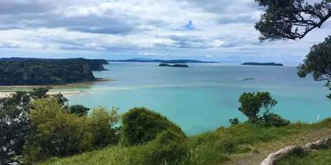
Waiwera
This loop track begins at the pouwhenua (carving) and takes you right around Maungatauhoro through areas rich in Maori history and beautiful forest. After the climb to the top of Maungatauhoro, follow the Couldrey Track (blue markers) to the junction of the Puhoi Track, which travels through an open grass area and rejoins the Perimieter Track at the base of the hill. It continues through regenerating bush near the park entrance.
Distance
3.6 km
Walking time
2 hours
Difficulty
Intermediate
Dogs
Not allowed
Wheelchair access
Not marked friendly
Current status
No active alerts found. Conditions can still change, so check again before leaving.
Weather outlook
Issued 10 Oct 2026, 4:55 pm
10 October 2026
Cloud increasing, and showers developing this evening. Northeasterlies.
11 October 2026
Showers, possibly heavy, easing to the odd light shower by midday. Scattered rain developing late evening. Northwesterlies.
12 October 2026
Showers becoming isolated in the morning but remaining cloudy. Northwesterlies developing in the morning.
13 October 2026
Mostly cloudy with isolated showers developing in the morning. Northwesterlies.
14 October 2026
Partly cloudy with isolated showers. Northwesterlies.
Regional guidance only; elevation and terrain can produce different conditions.
Explore the area
Explore the track route and surrounding area before you set out.
This loop track begins at the pouwhenua (carving) and takes you right around Maungatauhoro through areas rich in Maori history and beautiful forest. After the climb to the top of Maungatauhoro, follow the Couldrey Track (blue markers) to the junction of the Puhoi Track, which travels through an open grass area and rejoins the Perimieter Track at the base of the hill. It continues through regenerating bush near the park entrance.
Animals: Dogs are Prohibited. Smokefree regional parks: Our regional parks are smoke-free. Waste: All our regional parks are rubbish free. Take all rubbish and recycling with you when you leave. Outdoor fires: It is illegal to light a fire outside in all public areas in the Auckland region. For more information about the park and track, head to the Auckland Council website .
When visiting areas with healthy kauri trees, please make sure you follow these steps: Clean your footwear, tyres and equipment before and after visiting our kauri forests. If you are walking your dog, you should also make sure you clean their paws. Use cleaning stations every time you pass one while you are walking in a park. Stay on the tracks and keep off kauri roots. Stay away from closed tracks. Don't remove soil from, or bring soil into, areas with kauri trees.
Camp at the nearby Schischka Campground to extend your stay.
From Auckland travel north on SH1, take exit 386 onto Pōhuehue Rd. Follow this for approximately 4.5km until you reach a left turn for Schischka Rd, Wenderholm carpark is at the end of this road. Toilets available at the carpark. Use this location in Google Maps to find your way there.
We encourage you to continue gaining the skills and knowledge required for a safe trip. The NZ Mountain Safety Council has lots of free resources and information you can use. These can be accessed via www.mountainsafety.org.nz . Level up in your outdoor knowledge with these interactive online learning tools: Trip Planning Tramping / field Skills Basic Navigation River Safety Additionally, check out the range of helpful videos available from the NZ Mountain Safety Council YouTube channel .
Dogs Prohibited.
Track information, access and weather can change. Confirm current alerts and land-manager information close to departure, tell someone your plans, and carry equipment appropriate for the route and conditions.