11 October 2026
Showers about the Divide, clearing in the evening, otherwise fine.
Loading outdoor place details…
Nelson Lakes National Park
This challenging route leads from St Arnaud to Boyle Village, traversing Poukirikiri/Travers Saddle, Waiau Pass and Anne Saddle. It is part of Te Araroa.
Distance
122.95 km
Walking time
8-9 days
Difficulty
Advanced, Expert
Dogs
Not allowed
Wheelchair access
Not marked friendly
Current status
Weather outlook
Issued 11 Oct 2026, 7:33 am
11 October 2026
Showers about the Divide, clearing in the evening, otherwise fine.
12 October 2026
Fine.
13 October 2026
Isolated showers, becoming widespread in the evening.
14 October 2026
Heavy rain easing.
15 October 2026
A period of rain with snow to 700 metres, otherwise isolated showers.
Regional guidance only; elevation and terrain can produce different conditions.
Explore the area
Explore the track route and surrounding area before you set out.
Time: 3 hr Distance: 10.4 km Starting from the eastern end of Kerr Bay, the Lakehead Track winds through native forest, crossing shallow streams and stretches of shingle scree. Along the way, small lakeside beaches provide perfect spots for a picnic and offer stunning views of the surrounding mountains. At the head of Lake Rotoiti, you’ll reach the open grassy flats of the lower Travers Valley. From the jetty, it’s about a 15-minute walk to Lakehead Hut.
Time: 4 hr 30 min From Lakehead Hut, follow the Travers River flats through a mix of forest and open clearings. The track from Coldwater Hut joins here and passes the turnoff to Rotomaninitua/Lake Angelus. After about 1 hour 30 minutes of easy walking, you’ll reach a swing bridge and cross to the west bank of the Travers River. Beyond the bridge, the valley narrows and the terrain becomes more varied, alternating between forested terraces and grassy river flats. Keep an eye out for glimpses of Mount Travers as you approach Hopeless Creek. Cross the creek via another swing bridge, then leave the river behind as the track begins to climb. The gradient steepens briefly before easing, and soon you’ll hear the river again. After crossing a few small creeks, the track opens into a clearing where John Tait Hut awaits. Important: John Tait Hut sits below an avalanche path. Do not use the hut during storms or when snow reaches the valley floor.
Time: 3 hr Continue past John Tait Hut to the dramatic Cupola Creek chasm, where the track climbs steeply, leaving the river far below in its gorge. A sign marks a short side track to Travers Falls, a spectacular 20-metre cascade plunging into a deep rock bowl. Returning to the main route, the gradient soon eases as you cross several scree slopes before reaching a short bridge over the Travers River. Beyond this point, the forest becomes noticeably stunted, and although the track steepens again, there are occasional glimpses of towering peaks through the trees. Eventually the climb levels out and the track emerges onto a broad tussock-covered flat. Here, Upper Travers Hut sits at the base of the imposing east face of Mount Travers, offering a dramatic alpine setting for your overnight stay.
Time: 6–9 hr depending on conditions Poukirikiri/Travers Saddle is a challenging alpine pass that requires ice axes and crampons in winter and often well into spring. Be prepared for sudden weather changes, and note that the Sabine side of the saddle is particularly exposed to avalanche risk. From Upper Travers Hut, the track becomes a marked route with snow poles until the bushline on the Sabine side. Cross the Travers River near the hut and follow the poles through dense alpine shrubs. Leaving the boulder-strewn valley, the route steepens and zigzags up a scree slope before easing toward the saddle. At 450 metres above the hut, the saddle offers panoramic views and takes about 1 hour 30 minutes to reach. From the saddle, the descent is steep as the Sabine forks lie 1000 metres below. The route crosses tussock and scree, then briefly enters stunted beech forest before dropping into a steep gully. Zigzag down to the valley floor, where the track resumes and the walking becomes easier. Ten minutes further on, a bridge spans the deep chasm of the East Branch Sabine River. The track sidles around the edge of this chasm before descending into the West Branch Sabine River valley and heading upstream to reach West Sabine Hut. Watch the Poukirikiri/Travers Saddle Guide to the route over Poukirikiri/Travers Saddle.
Time: 3 hours Distance: 7.7 km From the West Branch Sabine swing bridge, head upstream. After about 1 hour 30 minutes, the valley widens and the track enters an area of forest that was destroyed by an avalanche in 1980. From here, climb steeply in two stages to reach a high basin where Blue Lake Hut is located. Rotomairewhenua/Blue Lake is considered the clearest natural freshwater lake in the world. It is sacred to iwi and highly vulnerable to aquatic biosecurity threats. Please respect this pristine environment by not washing, swimming, or touching the water. Camping is prohibited near the lake. This section of track crosses several avalanche paths, and avalanches often run to the valley floor in spring. Take extreme care and check conditions before setting out.
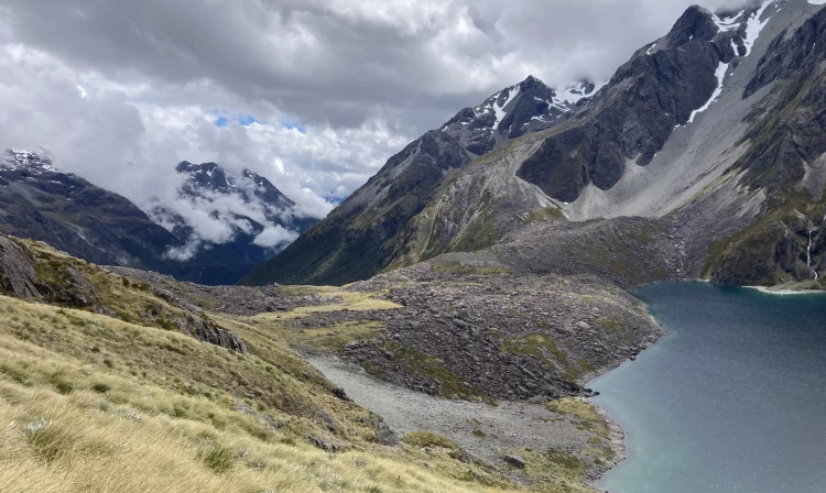
Time: 9-12 hr Check the weather before attempting Waiau Pass. Only cross in good conditions. If the weather is poor or the pass is covered in cloud, stay at Blue Lake Hut and wait for a better day. Start early, as the journey to Waiau Hut via the pass can take 9 to 12 hours. A campsite without a toilet is also available at Waiau Forks. Watch the Waiau Pass Guide for an overview of the route over the Waiau Pass. Blue Lake Hut to top of Waiau Pass From Blue Lake Hut, follow the signs, orange triangle markers, and orange poles heading south. The route climbs the moraine that dams Rotopohueroa/Lake Constance. Once on top of the moraine, continue along the marker poles that lead high above the cliffs on the western side of the lake. Do not follow the lake edge, as you will be blocked by impassable bluffs and deep water and will need to turn back. The route around the cliffs above Rotopohueroa/Lake Constance passes through steep guts and spurs before dropping back to the lake edge about 2.7 km from the hut. From there, it follows the shoreline to the lakehead. At the lake’s northern end, follow the route along the valley floor for approximately 1 km, with several stream crossings. The route then turns left (south) and begins climbing scree and steep rocky sections to Waiau Pass. It is approximately 1.5 km from the valley floor to the pass, with an altitude gain of 530 m. Hard icy snow can remain until December in the final 150+ metres of elevation, which can be very difficult to negotiate if conditions are unfavourable. Top of Waiau Pass to Upper Waiau Forks Be aware that the section from the top of the pass to the valley floor is very steep and technical, even in good conditions. There are many places where you could slip or become stuck, especially when snow and ice are present. From the top of the pass, assess conditions on the south side. Snow can be present at any time of year. If there is snow, do not proceed unless you have an ice axe, crampons, and avalanche rescue equipment, and know how to use them. If you are not equipped, return to Blue Lake Hut. Follow the orange markers down from the Waiau Pass summit, making sure you stay on the marked route. The route leads to the right from the summit rather than descending directly into the valley. The descent is steep and rocky, so take your time and watch your footing. When you reach the valley, the route follows the west branch of the Waiau Uwha River. It descends through scrub, then crosses the east branch of the river not far above the forks. Upper Waiau Forks to Waiau Hut It takes about 4 hours to travel from Waiau Forks to Waiau Hut. Follow the route down the true left of the river, passing a campsite without a toilet in a stand of beech and through a natural clearing. The route then crosses to the true right of the Waiau Uwha River and continues downstream. Take care, as the track may be overgrown in places. It is essential to follow the orange markers to stay on the best route. You will cross several side streams along the way, the largest being Caroline Creek. Topographic maps and the Mountain Safety Council video about the Waiau Pass Route mention Caroline Creek Bivvy. This bivvy has been removed, and there is no shelter or hut at this site. The nearest shelter is Waiau Hut, about one hour downstream from Caroline Creek.
Time: 7-8 hours From Waiau Hut, continue following the Waiau Uwha River downstream on the true right bank. The valley gradually widens, and you cross two old bush-covered terminal moraines. The route then follows the valley over broad grassy river flats until you reach the junction of the Waiau Uwha River and Ada River. Ada Homestead is privately owned, so trampers should avoid this area. Cross the Ada River. This crossing is usually straightforward in low or normal flows but may be unsafe if the river is high. After crossing, follow a vehicle track across the grassy flats and join the St James Walkway. Follow the St James Walkway up the Henry River valley to Anne Hut. Note that there is no longer a radio at Anne Hut.
Time : 7 hr Distance: 17 km The track crosses a footbridge over the Anne River to reach the true left, then about 2 km upstream it crosses another footbridge back to the true right. From there, the track climbs over Anne Saddle and descends into the Boyle Valley. Orange pole markers indicate the route across Boyle Flats, passing the basic Rokeby Hut. The track then follows the true left bank to a suspension bridge over the Boyle River, about 100 metres from Boyle Flat Hut.
Time: 4-5 hr Distance: 14.5 km After re-crossing the footbridge to join the walkway route on the true left bank, follow markers to the start of the track through the gorge. A suspension bridge crosses the Boyle River, then the track follows the true right bank to another suspension bridge. Magdalen Hut is 30 minutes from this second bridge. A vehicle track is joined and followed down the valley to the shelter and car park at SH7 by the Boyle settlement.
Waiau Pass is a very technical alpine crossing This route requires backcountry and snowcraft experience in all seasons. Waiau Pass is suitable for experienced parties only. Watch the Mountain Safety Council video about the pass and decide whether it is right for you and your group. Weather can deteriorate rapidly, and icy snow may be present at any time of year. Snowcraft skills are essential, and you should carry at least an ice axe and crampons. The best time to attempt this trip is between December and April. It is not recommended in winter or spring. This is a challenging and remote track This is extremely remote tramping. Always carry a distress beacon. Delays are common, even in summer, and trampers often wait extra nights at Blue Lake Hut for safe conditions to cross Waiau Pass. Carry enough extra food for several days and an emergency shelter in case you are trapped by high rivers. Freezing conditions and heavy rain can occur at any time of year, so take warm and waterproof clothing. Gear and preparation Watch the Mountain Safety Council video about Poukirikiri/Travers Saddle. Carry multi-day tramping gear. River safety If you plan to cross unbridged rivers, know how to cross safely and be prepared to wait if conditions are unsafe. Do not cross if the river is flooded, you cannot find safe entry and exit points, or you are unsure it’s safe. If in doubt, stay out. Wasps High numbers of wasps are present between January and April. Carry antihistamines and, if allergic, ensure you have appropriate medication. Avalanche terrain Waiau Pass is complex avalanche terrain with significant risk. Avalanches occur regularly in this area. From May to December, you need avalanche skills and equipment. If there is snow on the south side of Waiau Pass, do not continue unless you have an ice axe, crampons, and avalanche rescue gear—and know how to use them. Avalanche terrain also exists on other parts of the route, including the St James Walkway, Waiau Valley above the Caroline Bivvy site, the track to Blue Lake Hut, and the Travers–Sabine Circuit, which has more than 20 recognised avalanche paths. John Tait Hut is below an avalanche path—do not use it during storms or when snow reaches the valley floor. Check avalanche information for Nelson Lakes and St James Conservation Area, talk to staff at the Rotoiti/Nelson Lakes Visitor Centre, and review the NZ Avalanche Advisory . Respect Rotomairewhenua/Blue Lake and Rotopōhueroa/Lake Constance These lakes hold high cultural significance to Māori, particularly Ngāti Apa ki te Rā Tō iwi. They are tapu (sacred), and restrictions protect their mauri (life force) and purity. Do not touch the water. Do not swim, wash, take water, or put equipment into these lakes. This also helps prevent the spread of lindavia (lake snow), which is present in Lakes Rotoiti and Rotoroa.
Lakehead Hut Coldwater Hut John Tait Hut Upper Travers Hut West Sabine Hut Blue Lake Hut Waiau Hut Anne Hut Boyle Flat Hut Magdalen Hut
Northern track entrance/exit: St Arnaud township is 1 hour 30 minutes by road from Nelson or Blenheim. Turn off SH63 at St Arnaud onto Kerr Bay Road and continue on to Kerr Bay . The track starts at the eastern end of the bay. Southern track entrance/exit: Boyle village is on SH7 (Lewis Pass Rd).
We encourage you to continue gaining the skills and knowledge required for a safe trip. The NZ Mountain Safety Council has lots of free resources and information you can use. These can be accessed via www.mountainsafety.org.nz . Level up in your outdoor knowledge with these interactive online learning tools: Trip Planning Tramping / field Skills Basic Navigation River Safety Additionally, check out the range of helpful videos available from the NZ Mountain Safety Council YouTube channel .
No dogs.
Track information, access and weather can change. Confirm current alerts and land-manager information close to departure, tell someone your plans, and carry equipment appropriate for the route and conditions.